Creating a Historic Loss Assessment, Part 1: Native history and land dispossession

By calculating land dispossession, this report seeks to not only identify what has been taken from Native peoples but also how this theft became the original source of capital that built Colorado and the West.
Data Tools for Native Farmers

Data Tools for Native Farmers While the NLIS hosts a variety of resources related to agriculture on Native lands, this page highlights those that are specifically relevant to Native farmers. Native farmers are major contributors to their reservation economies, food systems, and land stewardship. The Native Lands Advocacy Project is committed to producing data tools […]
SSURGO Soil Classification Viewer for US Native Lands
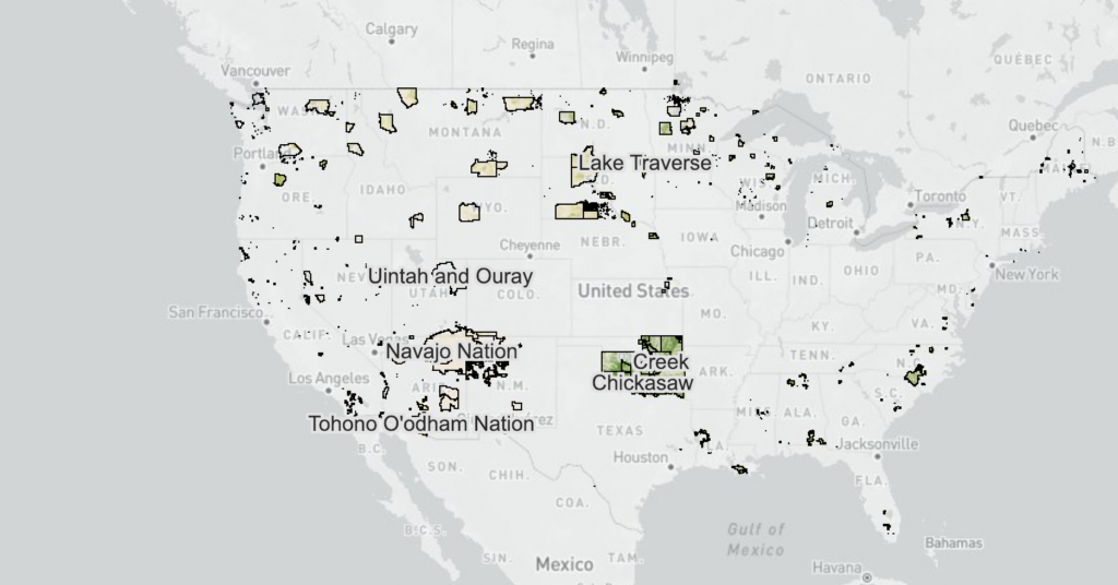
This map shows the canopy cover percentages and land cover types on Reservations and USFS lands.
Introducing the Historic Loss Assessment: Articulating lost lives, land, and resources for the Native Nations in your state
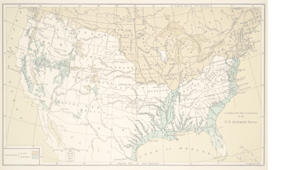
While much of settler colonialism’s harm to Native Nations is unquantifiable, assessments like this provide data that helps tell those Nation’s stories.
Renewable Energy Production on US Native Lands
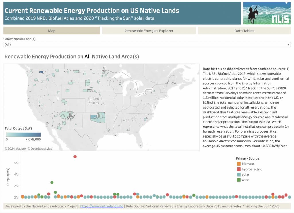
About this Dashboard This dashboard features current renewable energy production (wind, solar, biomass, and hydroelectric) on US Native Lands. It combines data from two sources: (1) the NREL Biofuel Atlas 2019, which shows operable electric generating plants for wind, solar, and geothermal sources sourced from the Energy Information Administration (2017), and (2) “Tracking the Sun,” a […]
Crop Diversity on US Native Lands
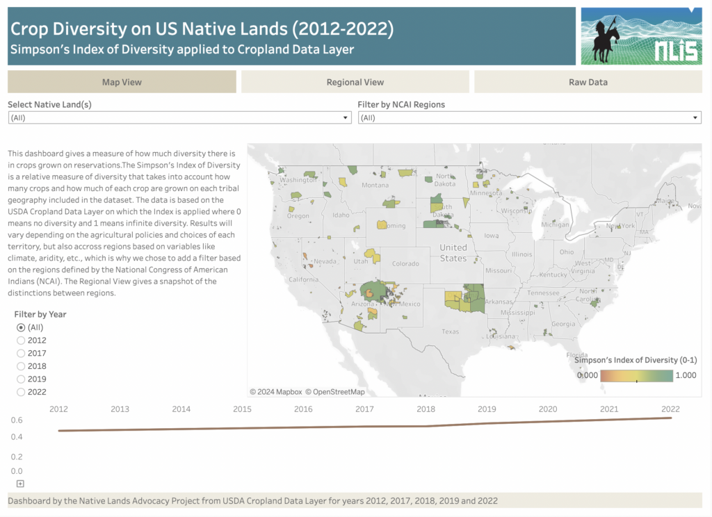
About this Dashboard The Crop Diversity Dashboard is an estimate of the relative diversity of crops grown on tribal lands. We use the Simpson’s Index of Diversity to estimate crop diversity from both the variety of crops grown and their respective acres within each reservation, with 0 meaning no crop diversity and 1 meaning infinite […]
Species Richness on US Native Lands
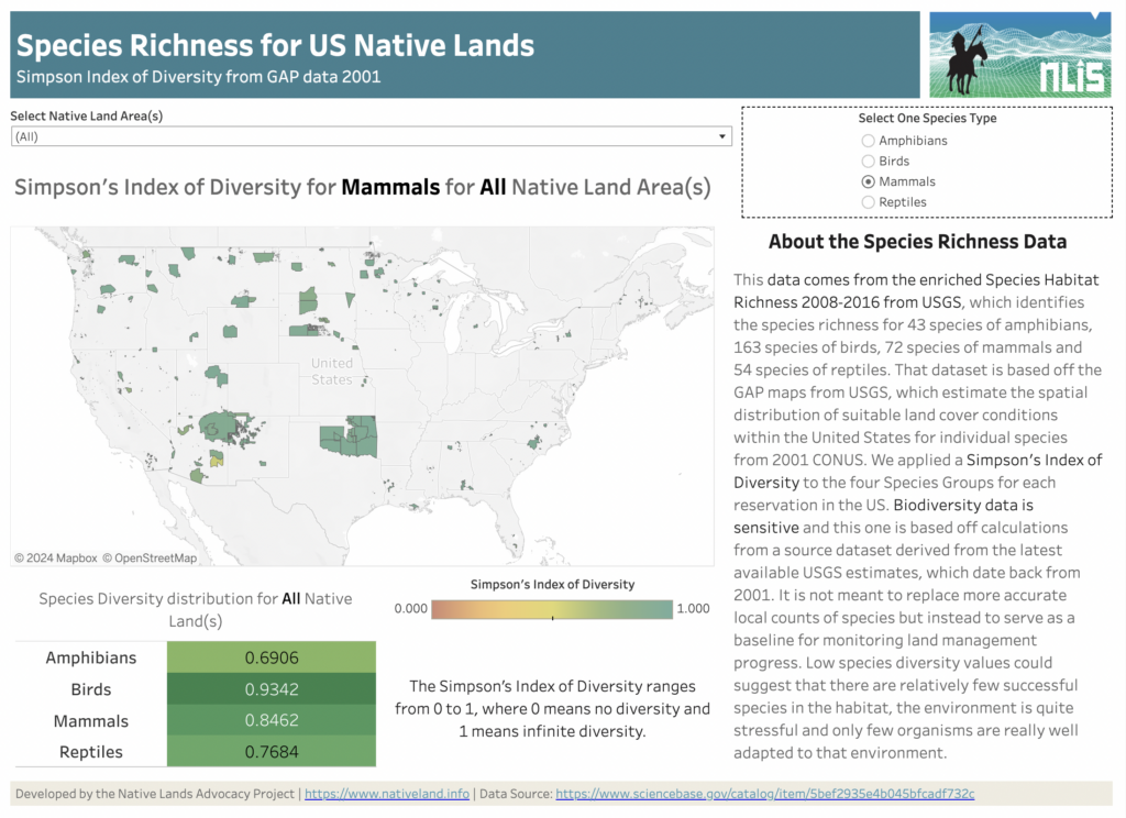
About this Dashboard Water Stress Categories 0 Native Land Areas 0 Datasets utilized 0 Possible Visualizations 0 About the Data This data comes from the Species Habitat Richness 2008-2016 from USGS, which identifies the species richness for 43 species of amphibians, 163 species of birds, 72 species of mammals, and 54 species of reptiles. This […]
Agricultural Water Stress on US Native Lands
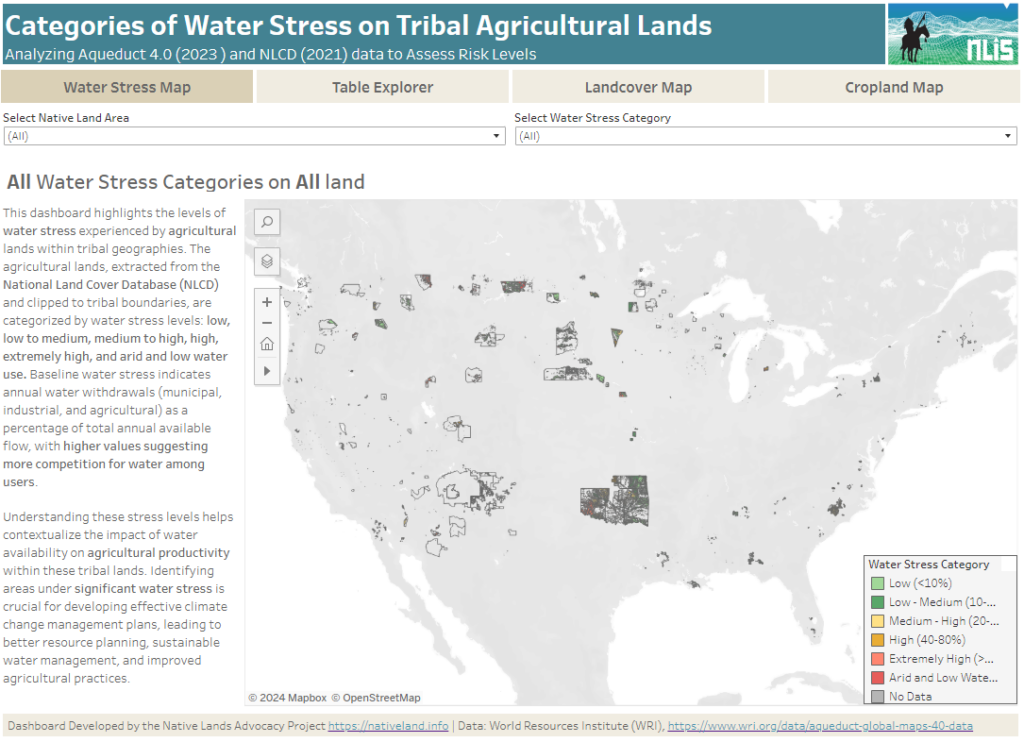
About this Dashboard This data dashboard summarizes data from the World Resources Institute, and the National Land Cover Database for Native Lands in the United States. It highlights the distribution and impact of water stress on agricultural lands within Native boundaries. The dashboard features detailed maps and interactive elements, allowing users to explore different water […]
Soil Organic Carbon Planning, Key to Building Tribal Climate Resiliency
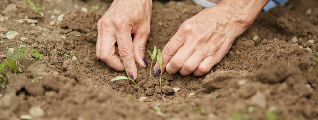
As tribes continue to experience the impacts of climate change on their lands and communities, they are starting to invest more of their resources and planning strategies into protecting and enhancing their soil organic carbon (SOC).
Crop Diversity on Native Lands
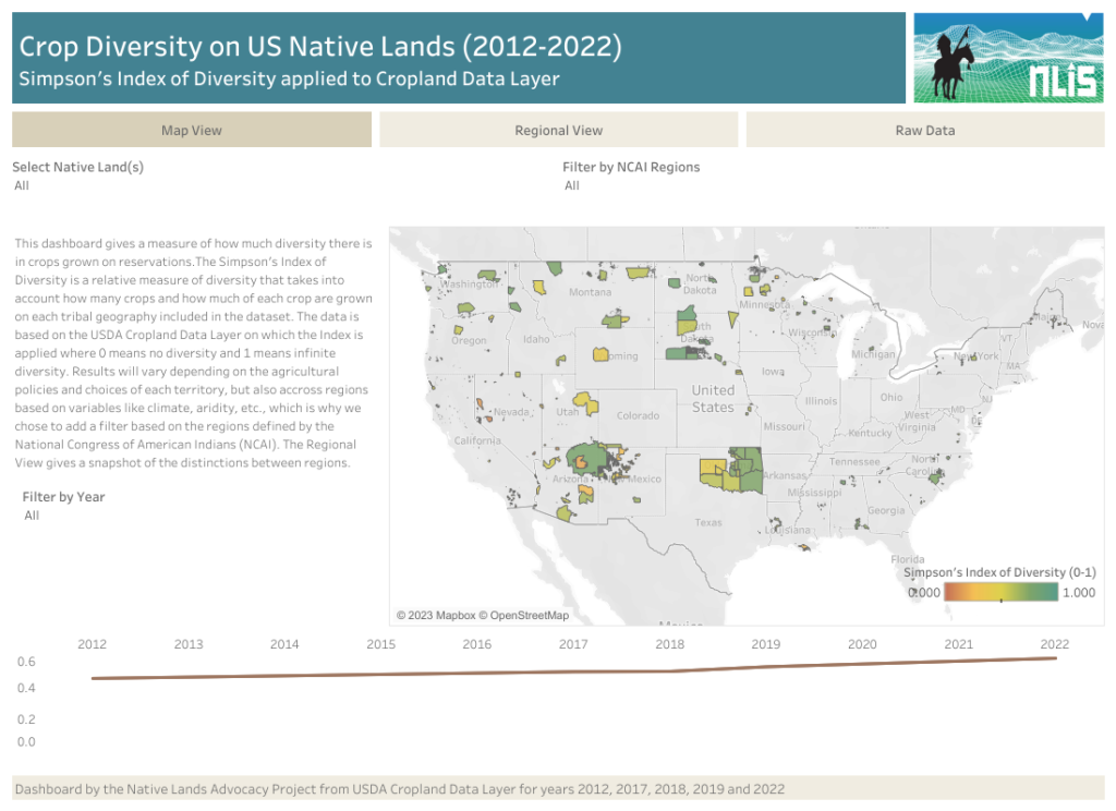
Our new Cropland Diversity data dashboard is the first index of Cropland Diversity ever calculated and published for US Native Lands. What findings does this dashboard reveal? And why does this data matter?
The Power of Asdzáán in Agriculture: Data Shows Native Female Majority Among Navajo Operators

Of the 73 reservations that participated in 2017 Census of Agriculture, only the Navajo Nation and the Umatilla Confederated Tribes reported a Native female majority among their agricultural operators.
Reservation Croplands: How Native Farmers and Ranchers Can Leverage the USDA’s Cropland Data Layer for Land Planning

In 2022, there were about 110 million acres of cropland (5.7%) on Native American reservations (including on-reservation and off-reservation trust lands). What are these croplands and land covers? How have they changed over time? Why does this data matter?
