-
2001 - Pine Ridge Strategic Planning Workshops Facilitated by Village Earth
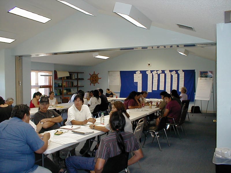
In 2001, Village Earth was asked to facilitate a series of strategic planning workshops by the Oglala Sioux Tribe’s Housing Authority. These strategic planning workshops took place over the course of one year and were conducted with resident tenant organizations in each of the nine districts in the Pine Ridge Reservation.
Starting in the 1960s, the U.S. government’s policy to address the poor standard of living on Pine Ridge was to move people off their lands and into clustered housing projects. This policy broke apart families and the relative self-sufficiency many families enjoyed on their own lands. This policy also made it easier for non-Natives to have nearly exclusive control over these lands through leasing.
The strategic planning workshops revealed that, overwhelmingly, the participants’ long-term goals were to move out of housing projects and back onto their own allotted lands with their tiospayes (extended families). The project was the beginning of Village Earth’s ongoing work with the Pine Ridge community in land recovery and land tenure.
-
2003 - Pilot Project with Red Cloud Family to Support Family Land Recovery Efforts
After the strategic planning workshops of 2001, Village Earth initiated a pilot project with the Red Cloud family on Pine Ridge. The goal of this project was to support the Red Cloud family’s land recovery efforts by learning what obstacles exist in the land recovery process. Village Earth came to have a working understanding of the web of red tape in the way of Lakota families who desire to live on, and benefit from, their own lands.
-
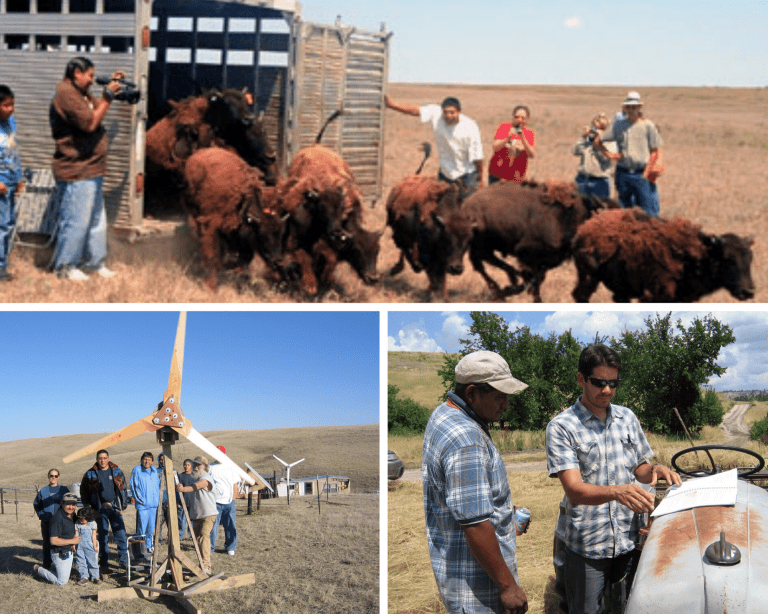
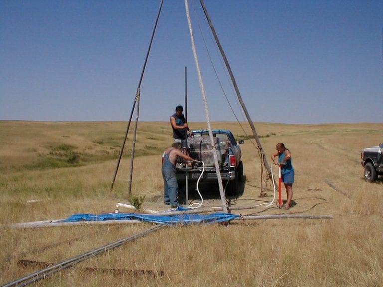
2004 to Present - Supporting Land Recovery Projects Across the Pine Ridge Reservation
These projects on Pine Ridge led to an ongoing relationship in which Village Earth supported families in land recovery efforts and across a variety of initiatives—gardens, renewable energy, fencing, biodiesel, establishing a marketing cooperative for Lakota Bison Caretakers, and releasing over 100 bison onto Lakota lands. Through this work, Village Earth continued to learn about and document the obstacles and opportunities related to Native land recovery. Some of the following points on this timeline are specific projects we worked on in this timeframe.
-
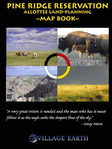
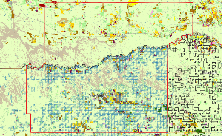
2006 - Allottee Land-Planning Map Book
In 2006, with support from the Indian Land Tenure Foundation, Village Earth compiled what we’d learned about land recovery into a book and distributed it for free through a series of strategic land planning workshops across the Pine Ridge Reservation. This Allottee Land-Planning Map Book included detailed maps and data that families could use for land planning on their allotments. The information in this book saves individuals at least a dozen trips to the BIA Realty Office. This project is in line with NLAP’s present-day mission of removing unnecessary barriers to the data and information needed for Native land planning.
-
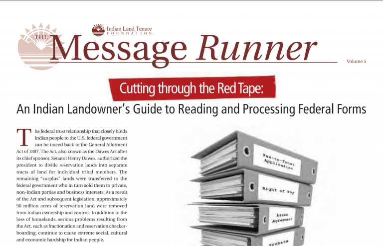
2011 - Cutting through the Red Tape
In 2011, Village Earth partnered with the Indian Land Tenure Foundation to produce Volume 5 of the Message Runner, a free educational publication that addresses specific topics related to Indian land tenure. This Message Runner was titled Cutting through the Red Tape: An Indian Landowner’s Guide to Reading and Processing Federal Forms. The publication contains a collection of federal forms used in the management of Indian lands and assets, accompanied by explanations about how to read and process the forms. Through this publication, we sought to replicate what we had developed for Pine Ridge in our Strategic Land-Planning Map Book on a national scale, and the experience taught us that what we had been doing on Pine Ridge was needed on a national scale.
-
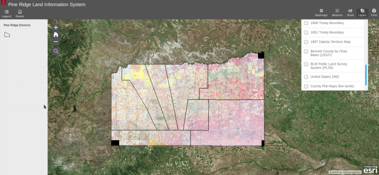
2012 - Launching the Pine Ridge Land Information System
We adapted our map book into an interactive online resource using advancing web-based mapping technology. Developed in partnership with the Oglala Sioux Tribe’s Land Office, the Pine Ridge Land Information System makes it possible for Lakota landowners to locate their lands using their Tract ID. The site also includes historic treaty boundaries, original allotment maps, county platte maps, range units, and other data needed by the OST and Lakota landowners to manage and plan for their lands. We realized that advancing technology is making it easier to access and distribute massive amounts of data at a low cost compared to print media.
-
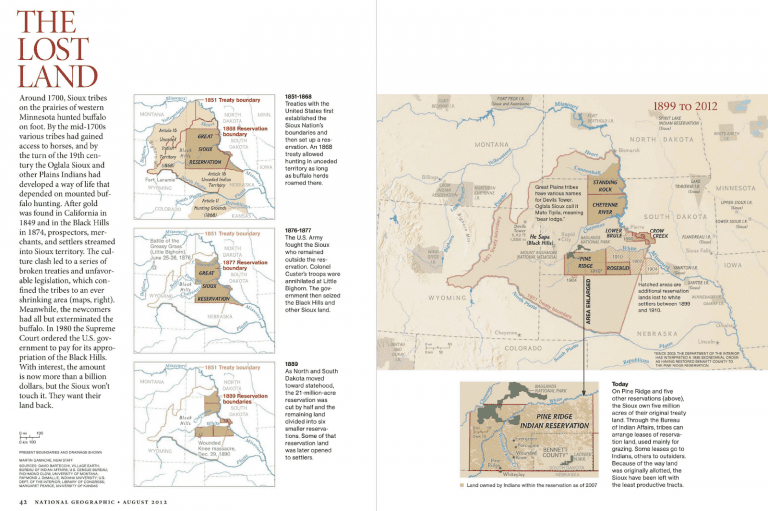
2012 - Consulted on Pine Ridge Maps for August Issue of National Geographic Magazine
In 2012, Village Earth was asked to consult on the maps for the August 2012 edition of National Geographic. During our research, the status of Bennett County in South Dakota came into question. We discovered that the State of South Dakota's interpretation (that Bennett County is not part of the Pine Ridge Reservation) differed from the Federal interpretation. As a result, National Geographic decided to include the county as part of the reservation in their maps. Through this experience, we realized that having access to boundary and land status data is necessary to be able to interrogate the legitimacy of those boundaries.
-
2017 - Feasibility Study to Calculate Lost Agriculture Revenue From Ceded Indian Lands
Upon invitation by the Indian Land Tenure Foundation, Village Earth was asked to research whether we could obtain over 100 years of land status, agricultural, and leasing data in order to calculate historic lost agricultural revenue from ceded Native lands. We scoured the internet, academic libraries, the National Archives, and the Library of Congress, then submitted two FOIA requests to the BIA. We discovered that, in addition to the U.S. government's failure to protect Native lands from being exploited by non-Natives, there has effectively been a cover-up of the extent of the exploitation by the U.S. government’s failure to properly document and publish data on agriculture and leasing. We also discovered that vast amounts of data and information exist that would be valuable to Native peoples; however, this data can't be used because it is aggregated at the state and county levels and not within reservation boundaries (which often overlap with state and county boundaries).
-
2019 - Birth of the Native Land Information System and the Native Lands Advocacy Project
In 2019, the Native Land Information System (NLIS) was born out of a continuation grant from the Indian Land Tenure Foundation to build upon, and share the findings of, the feasibility study that Village Earth began in 2017. The NLIS was developed as a repository where public datasets could be made accessible and usable to the Native communities who might benefit from them. The Native Lands Advocacy Project (NLAP) was created as a distinct team within Village Earth to maintain and grow the NLIS.
Since 2019, our work has grown, as well as our team. We’re honored to be guided and funded by multiple trusted partners in Indian Country, and we continue to be committed to creating access to useful public data for the furtherance of Native sovereignty in the United States. Our tools tend to fall along two axes: data that helps document historical land oppression, and data that supports sustainable land planning. Please contact us if you have any questions or suggestions about our work.