Surface Waters on Native Lands Dashboard
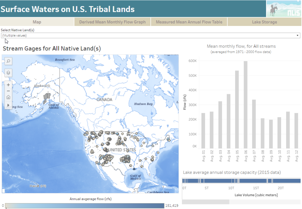
About this Dashboard This data includes the USGS’s National Hydrography Plus Dataset V2 (NHDPlus), released in 2012, and the 2021 TIGER Boundaries for U.S. American Tribal lands as of January 1st, 2021, as reported by the federally recognized tribal governments through the Census Bureau’s Boundary and Annexation Survey (BAS). Overlapping features and associated data from […]
Announcing Update to our Cropland Data Layer Dashboard!
Our “What’s Growing on Native Lands?” Dashboard is now updated with the 2021 data from the United States Department of Agriculture’s (USDA) Cropland Data Layer, making our dashboard a more timely resource for Native land caretakers to use in monitoring the status of their homelands! According to the the USDA, the Cropland Data Layer (CDL) is […]
New Updates to our SSURGO (Soil Survey) Dashboard!
We have compiled and uploaded the most recent data from the 2021 Soil Survey Geographic Database (SSURGO) into our “Soil Capability on CONUS Native Lands” Dashboard! According to the Natural Resources Conservation Service (NRCS), The SSURGO database provides the most detailed level of information and was designed primarily for farm and ranch, landowner/user, township, county, […]
Announcing Our New “Preserving Intact Habitat on Native Lands” Storymap!
What is intact habitat, and why is it important? How has preserving intact habitat been the key to addressing tribal priorities? What resource tools exist for tribes to utilize in their own intact habitat planning? To help answer these questions and more, NLAP is happy to announce our new storymap, Preserving Intact Habitat on US […]
Preserving Intact Habitat on US Native Lands

Thermal Activity on US Native Lands
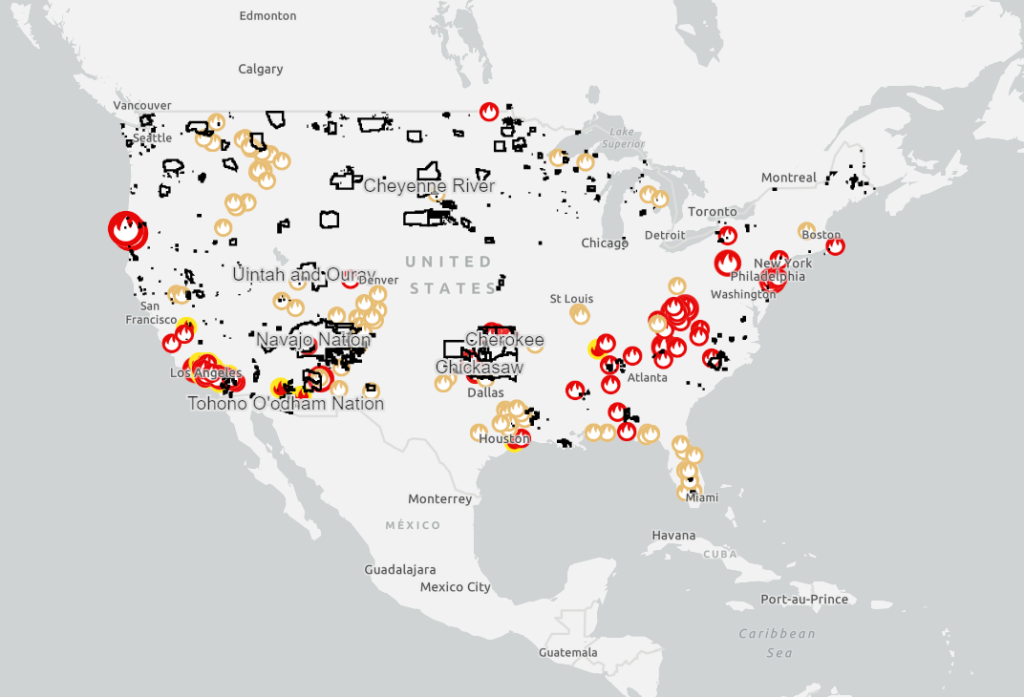
This map shows satellite detected hotspots and wildfire activity provided by federal, state, and local agencies.
Intact Habitat on US Native Lands
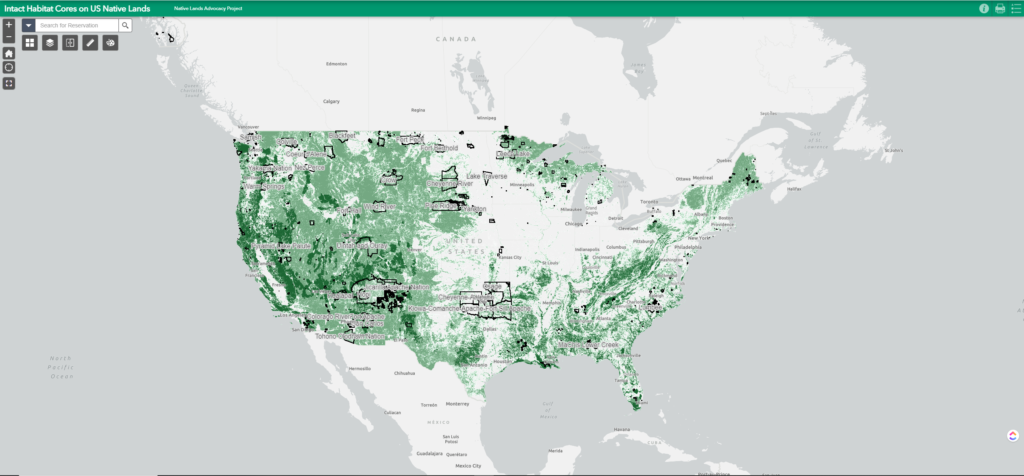
This layer represents modeled Intact Habitat Cores, or minimally disturbed natural areas at least 100 acres in size and greater than 200 meters wide.
RAP – Rangeland Analysis Platform
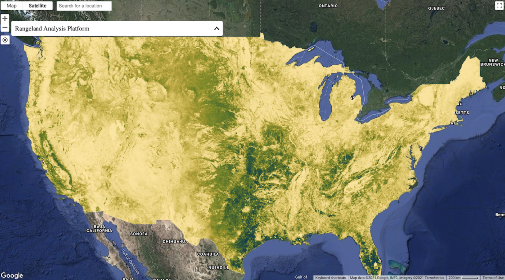
Fast, powerful, and free, the Rangeland Analysis Platform is an innovative online tool that quickly visualizes and analyzes vegetation data for the United States. Launch the app to examine trends at pasture, ranch, watershed, or broader scales. Datasets include:
Announcing New Updates to Our National Land Cover Database Dashboard!
By Raven McMullin // April 18, 2022 NLAP remains committed to making available to Tribes, Native organizations, and land caretakers the most relevant and current data critical for Native land planning and research. In furtherance of this commitment, we are excited to announce new updates to our National Land Cover Database Dashboard (NLCD) along with a […]
Intact Habitat Selector Tool
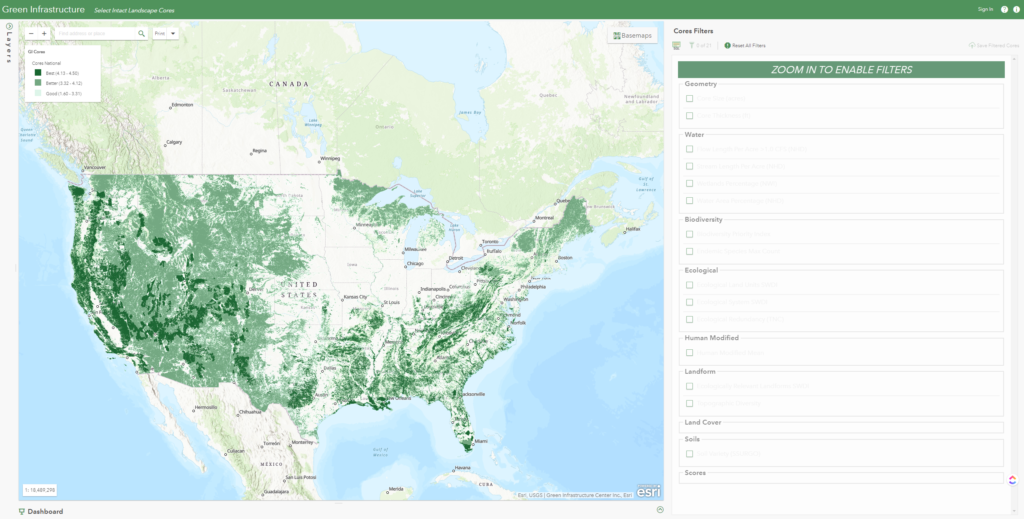
Explore and filter a national database of intact landscape cores to identify important habitat your tribe seeks to protect based on species richness, water availability, landscape variability, soils, etc.
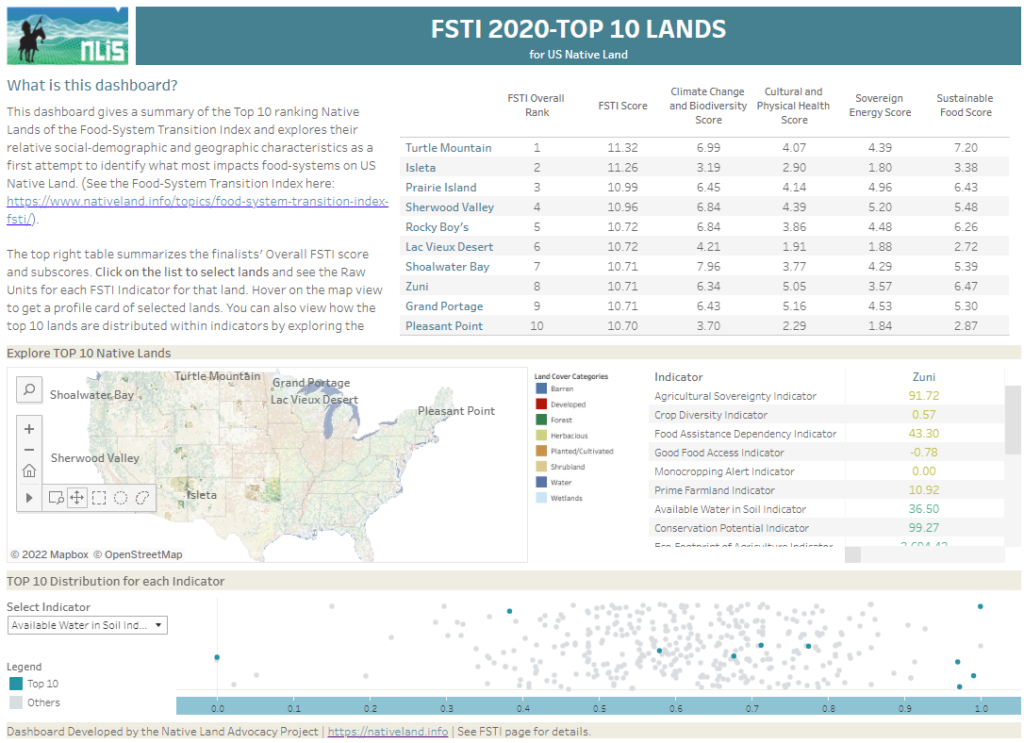
Top 10 Native Lands in the Food-System Transition Index of 2020
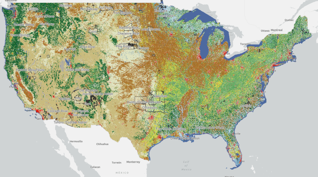
National Land Cover Database: Tribal Lands Viewer
This map viewer visualizes every available year of the National Land Cover Database (NLCD) and makes it possible to filter for 848 native land areas (reservations and off reservation trust lands) in the United States for 2001 and 2019.