Precipitation Projections and Winter Trends on US Native Lands
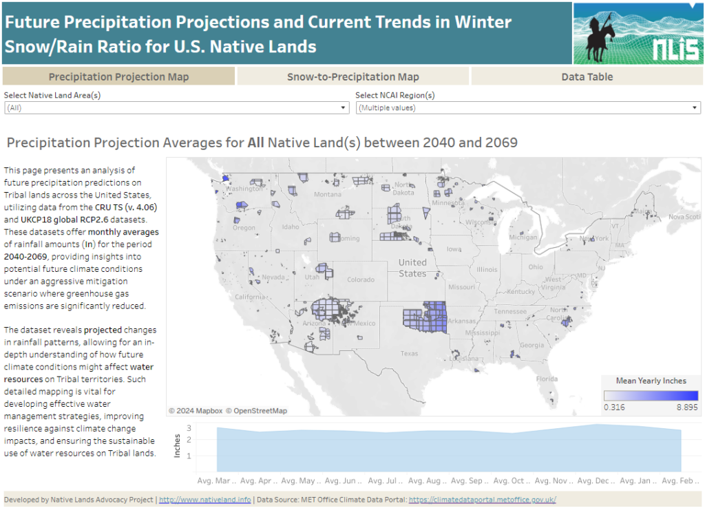
About this Dashboard This data dashboard summarizes data from future precipitation predictions and historical changes in the snow-to-precipitation ratio on Tribal lands in the contiguous United States. The precipitation predictions are based on datasets from the CRU TS (v. 4.06) and UKCP18 global RCP2.6 scenarios, while the snow-to-precipitation ratio data comes from 177 weather stations […]
Agricultural Water Stress on US Native Lands
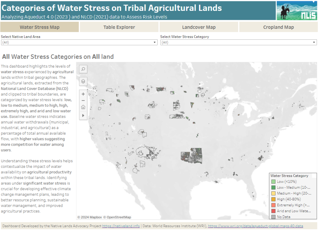
About this Dashboard This data dashboard summarizes data from the World Resources Institute, and the National Land Cover Database for Native Lands in the United States. It highlights the distribution and impact of water stress on agricultural lands within Native boundaries. The dashboard features detailed maps and interactive elements, allowing users to explore different water […]
Rivers of Broken Promises: An Exploration of the Water Challenges Faced by Lakota Communities
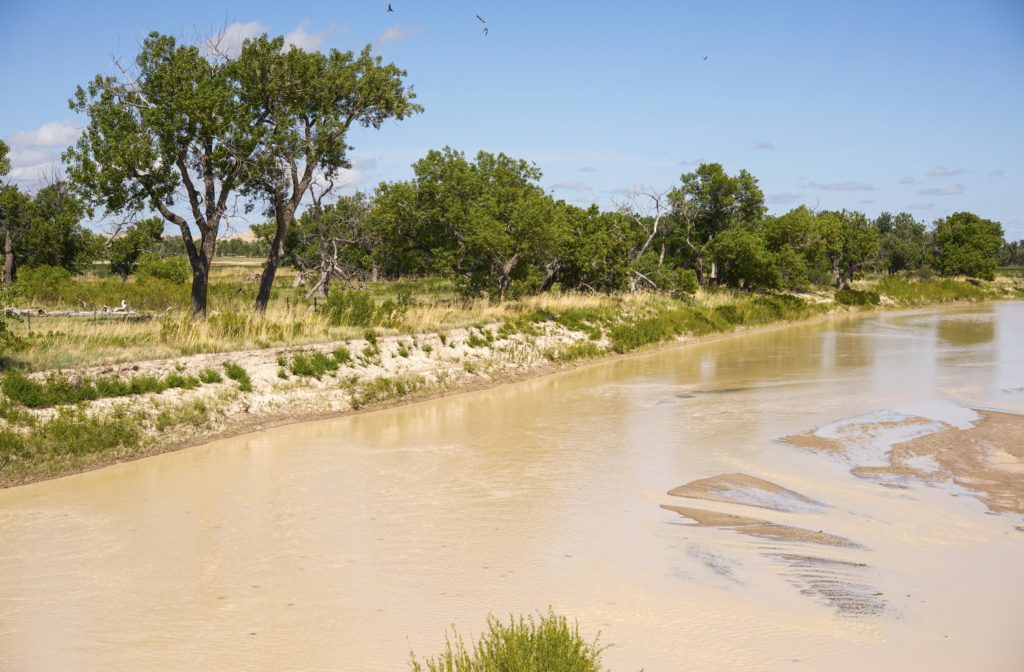
This blog is the first of two posts analyzing the challenges Native communities face in accessing clean, sustainable water.
Ground Water on US Native Lands
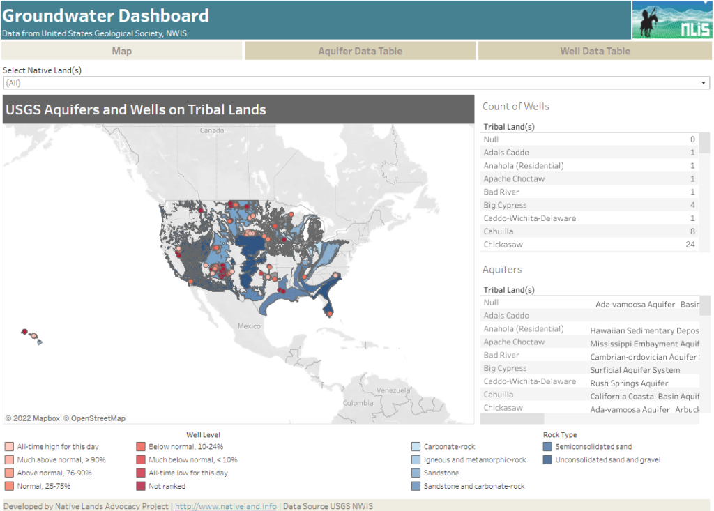
About this Dashboard This data dashboard summarizes data from the National Ground-Water Monitoring Network, and the national datasets of principle aquifers and aquifers of alluvial and glacial origin for Native Lands in the United States. This data shows underlying water resources and data monitoring the condition of wells on Native Lands. 0 Aquifer Types 0 […]
Surface Waters on Native Lands Dashboard
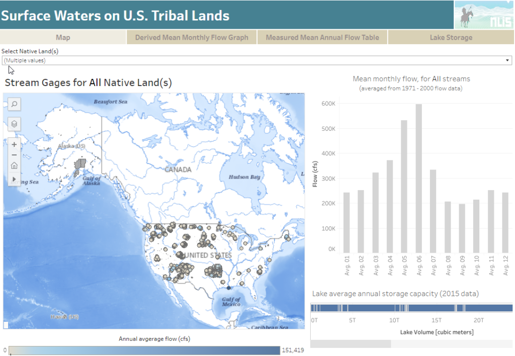
About this Dashboard This data includes the USGS’s National Hydrography Plus Dataset V2 (NHDPlus), released in 2012, and the 2021 TIGER Boundaries for U.S. American Tribal lands as of January 1st, 2021, as reported by the federally recognized tribal governments through the Census Bureau’s Boundary and Annexation Survey (BAS). Overlapping features and associated data from […]
New Tool for Native Land Caretakers: The Rangeland Analysis Platform (RAP)
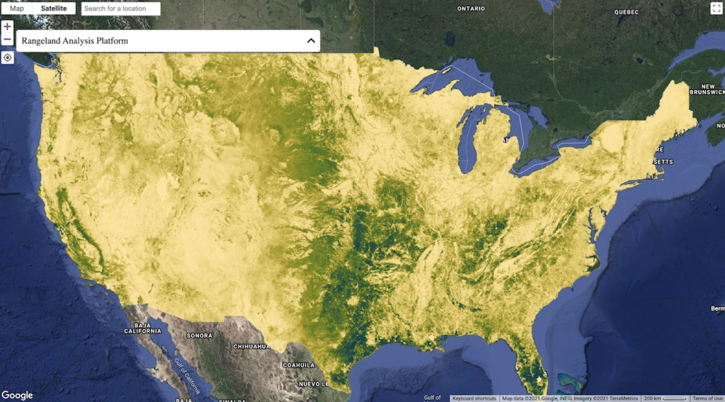
According to the NLIS’s National Land Cover Database dashboard, in 2019, there were approximately 26 million acres of rangeland within Native American reservations and off-reservation trust lands. Now, say that you are a Tribal natural resource manager, an established rancher, or land owner—it is no secret that adequately monitoring this vast land base, whether owner-managed […]
Sustainable Food Systems for US Native Lands: A Story Untold
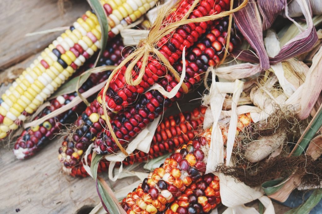
The myth of an “empty land” where Natives lived idly without making good use of their natural resources is persistent and served as the primary base to justify taking lands away from tribes. Contrary to stereotypes, Native Agriculture was diverse and flourishing prior to settler colonialism.