Soil Organic Carbon Planning, Key to Building Tribal Climate Resiliency
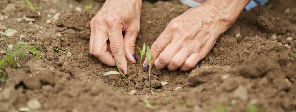
As tribes continue to experience the impacts of climate change on their lands and communities, they are starting to invest more of their resources and planning strategies into protecting and enhancing their soil organic carbon (SOC).
Assessing Food Resilience on Native Reservations: the Good Food Access Indicator

NLAP’s Good Food Access Indicator (GFAI) helps Native communities challenge those who look at Native food systems through a deficit lens by creating a new way to measure food access on the reservation.
Crop Diversity on Native Lands
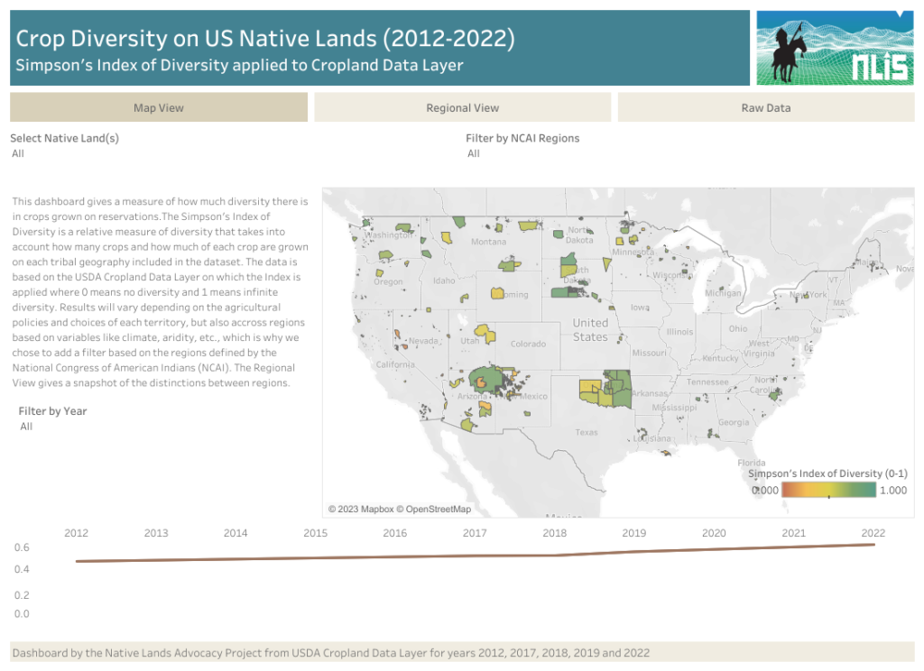
Our new Cropland Diversity data dashboard is the first index of Cropland Diversity ever calculated and published for US Native Lands. What findings does this dashboard reveal? And why does this data matter?
The Power of Asdzáán in Agriculture: Data Shows Native Female Majority Among Navajo Operators

Of the 73 reservations that participated in 2017 Census of Agriculture, only the Navajo Nation and the Umatilla Confederated Tribes reported a Native female majority among their agricultural operators.
Reservation Croplands: How Native Farmers and Ranchers Can Leverage the USDA’s Cropland Data Layer for Land Planning
In 2022, there were about 110 million acres of cropland (5.7%) on Native American reservations (including on-reservation and off-reservation trust lands). What are these croplands and land covers? How have they changed over time? Why does this data matter?
Quantifying Disparities in Agricultural Revenue on Native Lands
According to our Lost Agriculture Revenue Database, non-Native farmers have made $749,517,889,778 in agricultural revenue (85.7% of total revenue) on Native reservations since 1840, while Native farmers have made $125,018,539,082 (14.3% of total revenue). What factors contribute to this shocking disparity in agricultural revenue? And what do these numbers really represent for Native communities?
International Day of Biological Diversity: Data Tools for Indigenous Stewardship

Indigenous models of reciprocity and responsibility in land-caretaking offer an alternative to the extractive, exploitative, and commodified ways of relating with the land that are dominant in Western practice.
Soil Organic Carbon for Land Planning on Native Lands
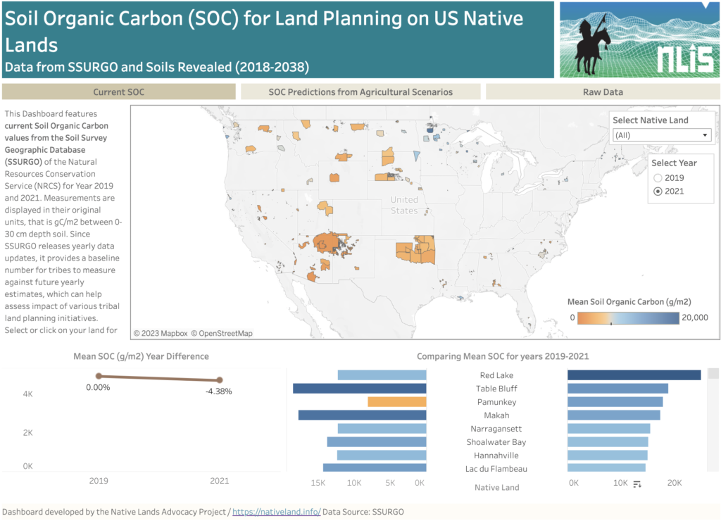
About this Dashboard This data dashboard summarizes past and present Soil Organic Carbon (SOC) data for all Native Lands but also future estimates depending on different agricultural scenarios. Data comes from the Soils Survey Geographic Database (SSURGO) for past and most to date available values (2019 and 2021). For future scenarios, we used estimates from […]
Grasslands: The Lands and the People That Call Them Home
Take a deep dive into the world of grasslands and learn more about: different characteristics of grasslands, Native care of grasslands historically and today, and how grasslands serve and support our world’s ecology, economies, and climate.
Forest Lands Viewer
This map shows the canopy cover percentages and land cover types on Reservations and USFS lands.
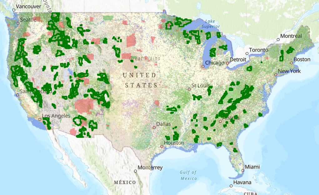
Preserving Intact Habitat on US Native Lands

In this interactive storymap, we walk through the importance of habitat connectivity for Native lands in the United States, approaches to promoting habitat connectivity provided by Esri, and how different data tools — one of which being our very own intact habitat layer — may be used for further tribal protection of their homelands and non-human relatives.
Intact Habitat on US Native Lands
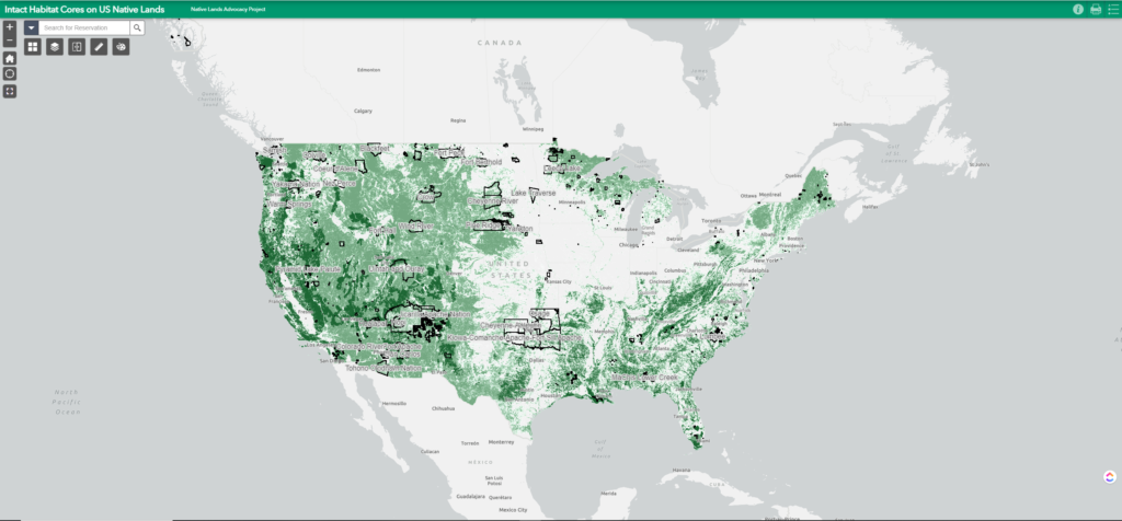
This layer represents modeled Intact Habitat Cores, or minimally disturbed natural areas at least 100 acres in size and greater than 200 meters wide.