Understanding Wind Speed on Native Lands

Wind plays a significant role in shaping ecosystems, affecting infrastructure planning, and in overall renewable energy potential. Recognizing this, the Native Lands Advocacy Project (NLAP) developed an Average Wind Speed data dashboard as part of our Climate Data Portal for U.S. Native Lands. Read on to learn more about this dashboard and explore two potential […]
New to the NLIS? Start here!
The Native Lands Advocacy Project (NLAP) compiles, consolidates, and visualizes data resources to support sovereign, sustainable, Native-led land planning and protection.
Empowering Tribal Climate Adaptation Through Data

Learn more about the first-of-its-kind Climate Data Portal for US Native Lands—designed to strategically support tribal climate planning.
Introducing the Climate Data Portal for U.S. Native Lands

The Native Lands Advocacy Project (NLAP) is thrilled to announce the launch of our Climate Data Portal for U.S. Native Lands! Developed with funding from the Native American Agriculture Fund, this portal is the result of our dedicated GIS team’s efforts to create & consolidate relevant climate-related data tools into one living resource. NLAP acknowledges […]
Average Wind Speed on US Native Lands
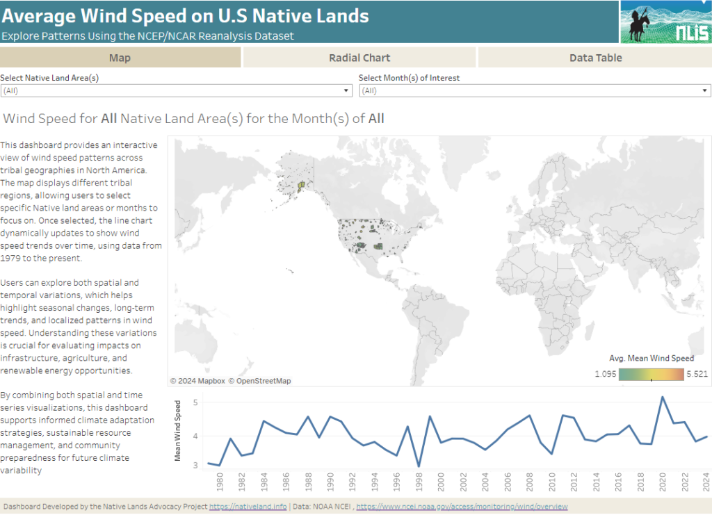
About this Dashboard This interactive dashboard provides a comprehensive analysis of average wind speed patterns across tribal lands in North America, using data from the NCEP/NCAR Reanalysis dataset. The dashboard allows users to explore wind speed trends by selecting specific Native land areas and years, or by viewing aggregated data across all regions and years. […]
Energy Access Viewer
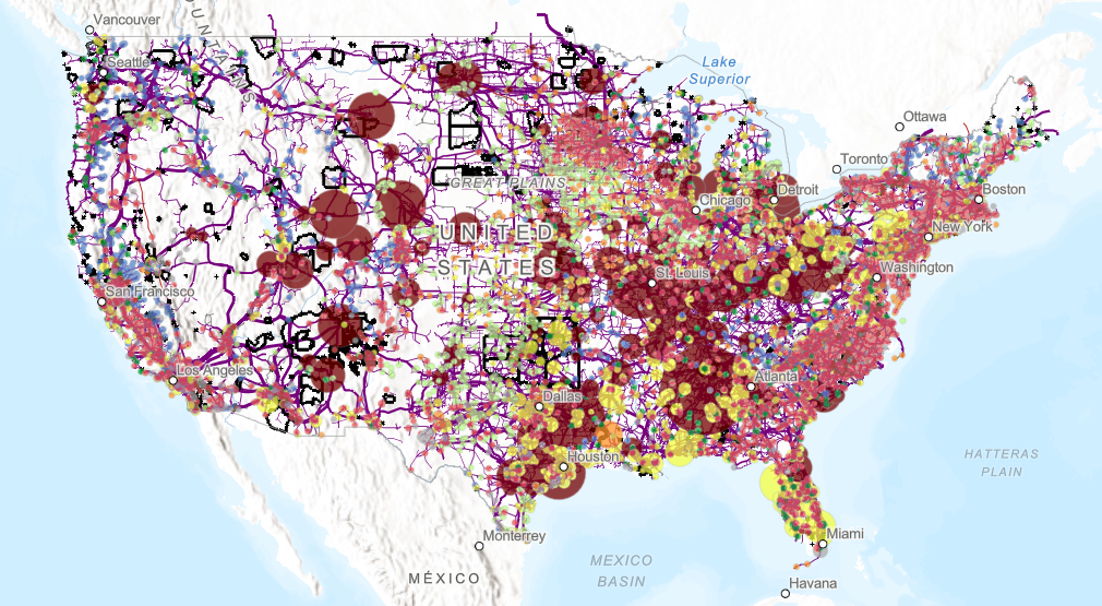
Explore detailed data on power plant emissions, energy generation, and infrastructure with our interactive dashboard. Specifically designed for US Native Lands, it provides insights into environmental impacts and energy dynamics in these regions.
Elevation Profile Explorer
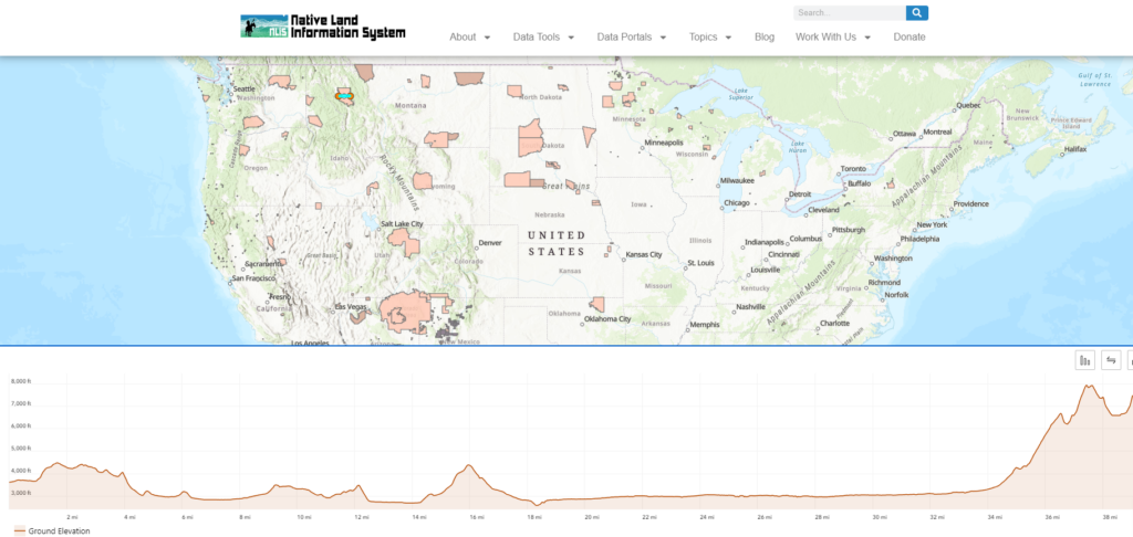
Welcome to the Elevation Profile Explorer, a powerful tool designed to help you understand the terrain and elevation changes across Native lands in the United States.
Good Fire: Mitigating Wildfire Risk & Healing Native Lands
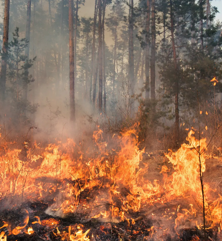
After a long history of fire suppression in the United States, Native communities are reintroducing good fire to their lands.
Precipitation Projections and Winter Trends on US Native Lands
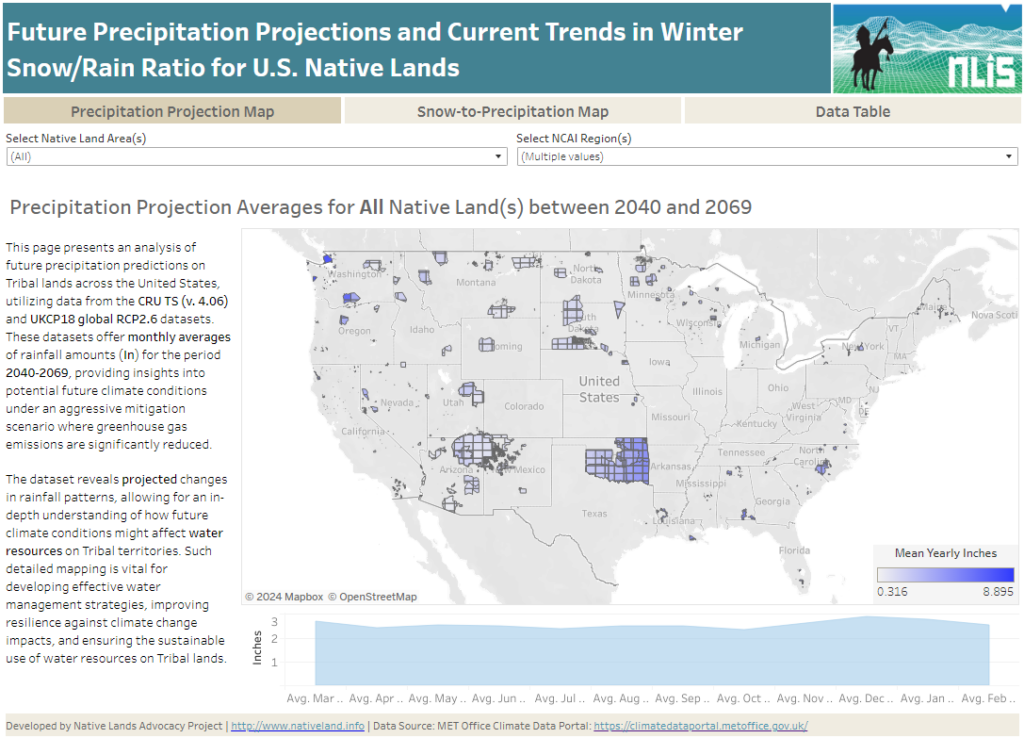
About this Dashboard This data dashboard summarizes data from future precipitation predictions and historical changes in the snow-to-precipitation ratio on Tribal lands in the contiguous United States. The precipitation predictions are based on datasets from the CRU TS (v. 4.06) and UKCP18 global RCP2.6 scenarios, while the snow-to-precipitation ratio data comes from 177 weather stations […]
Change in Rain & Snow Patterns on U.S. Native Lands
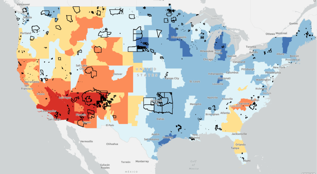
This map displays data layers based on the EPA’s Climate Change Indicators in the United States report, specifically focusing on Change in Rain & Snow Patterns on U.S. Native lands. On this map, view layers related to change in snowfall, precipitation, snow-to-precipitation ratio, and April snowpack in western US.
Temperature Change Patterns on U.S. Native Lands
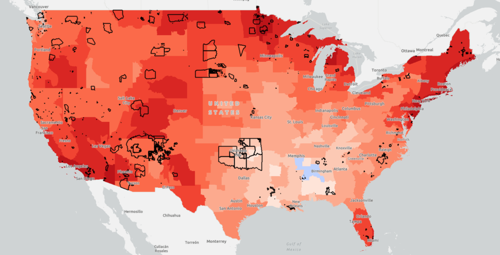
This map displays data layers based on the EPA’s Climate Change Indicators in the United States report, specifically focusing on Temperature Change Patterns on U.S. Native lands. On this map, view layers related to annual average air temperatures, unusually hot temperatures, and unusually low temperatures.
Environmental Risks for US Native Lands (Drought, Heat, Rain, Wildfire: 1980-2020)
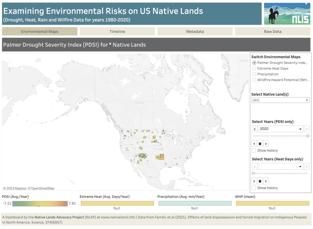
About this Dashboard This dashboard shows key environmental risks data for US tribal lands to help tribes monitor and assess risks and incorporate them in their land planning and decision-making. Data comes from the recent article: Farrell, J., Burow, P. B., McConnell, K., Bayham, J., Whyte, K., & Koss, G. (2021). Effects of land dispossession […]