Here’s What We Know About the 2026 Federal Budget for Indian Country
Every year, the United States Congress begins the process of appropriating funds for the following fiscal year. While it’s important that voters are aware of these funding decisions in order to advocate for their areas of concern—and it is especially vital for Tribal Nations and their citizens to assess how the U.S. is meeting its […]
Understanding the 2026 Federal Budget for Indian Country
Here’s what we currently know about proposed funding levels for the BIA, BIE, and BTFA as of September 30, 2025.
Creating a Historic Loss Assessment, Part 4: Extermination of buffalo and other significant losses
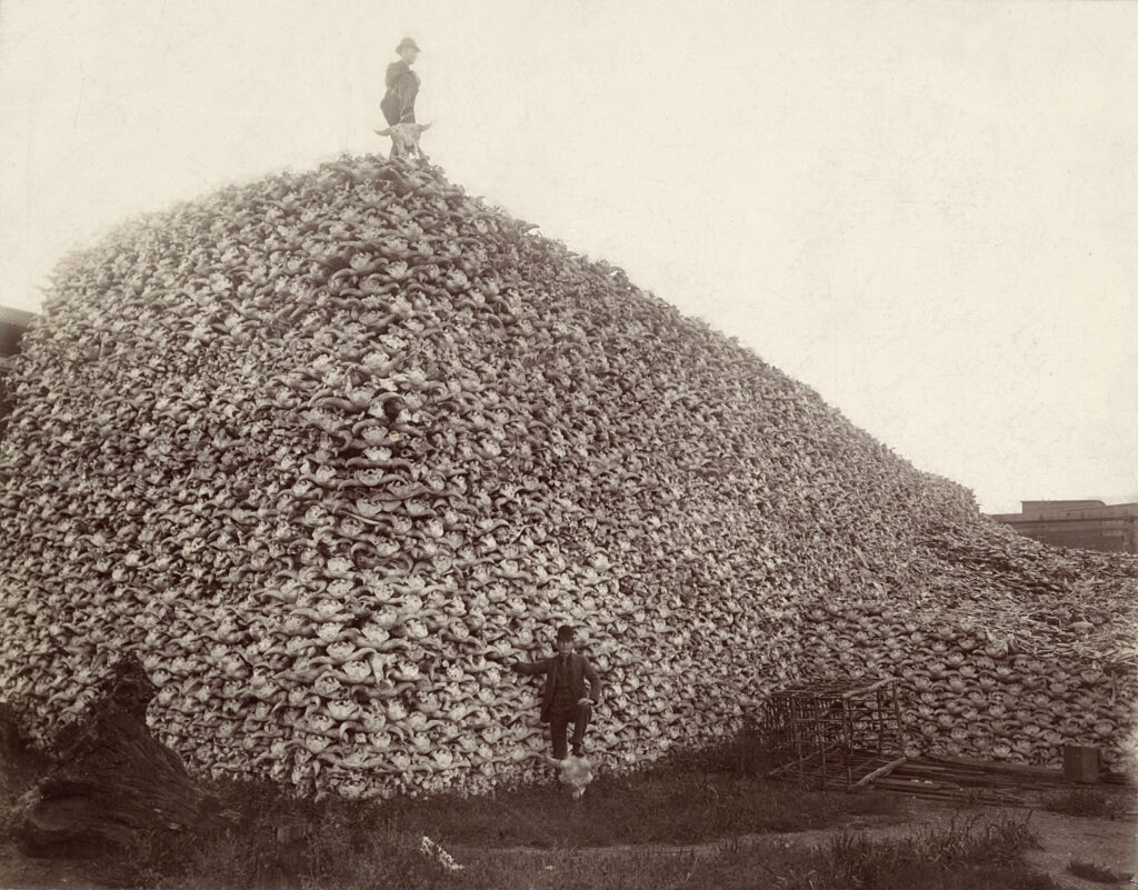
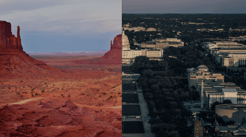
By calculating land dispossession, this report seeks to not only identify what has been taken from Native peoples but also how this theft became the original source of capital that built Colorado and the West.
New Storymap: Visualizing Federal Spending in Indian Country

Learn about three new data tools that allow users to access relevant data about federal investments in Indian Country.
Articulating Losses for the Native Nations in Your State
Learn about the Historic Loss Assessment: a powerful report that quantifies lost lives, land, and resources for Native Nations.
Visualizing Federal Spending in Indian Country

The Native Lands Advocacy Project recently published three data dashboards that focus on federal spending as it relates to tribes.
Creating a Historic Loss Assessment, Part 3: Illegal settlements and loss of agricultural revenue

By calculating land dispossession, this report seeks to not only identify what has been taken from Native peoples but also how this theft became the original source of capital that built Colorado and the West.
Creating a Historic Loss Assessment, Part 2: Loss of life and Extraction of minerals
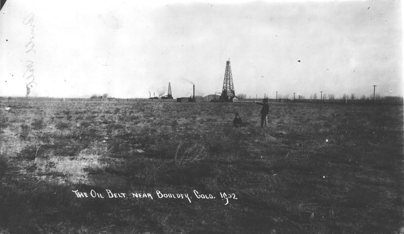
By calculating land dispossession, this report seeks to not only identify what has been taken from Native peoples but also how this theft became the original source of capital that built Colorado and the West.
Federally-funded Projects in Indian Country

About this Dashboard This data dashboard summarizes data about federally-funded projects within tribal boundaries from the Bipartisan Infrastructure Law and the Infrastructure Reduction Act. The visualization displays funds amounts and categories of federal project for all tribes for years 2022 through 2025 (it has not been modified for eventual funding freezes resulting from the current […]
Bureau of Indian Affairs Budget by Categories
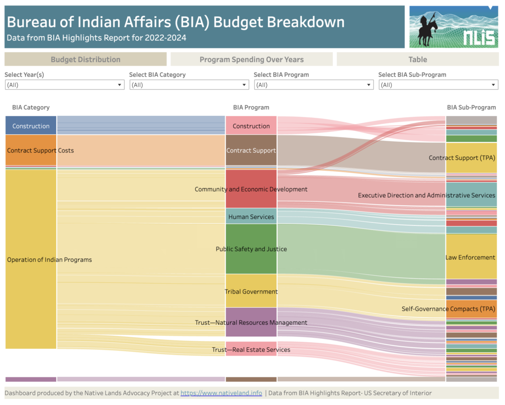
About this Dashboard This data dashboard summarizes data from the United States Secretary of Interior; it features the Bureau of Indian Affairs Yearly Highlights Reports, which show BIA spending by categories, programs and subprograms for years 2022, 2023, annualized CR (estimates) for 2024 and requested budget for 2025. We digitized these static reports in an […]
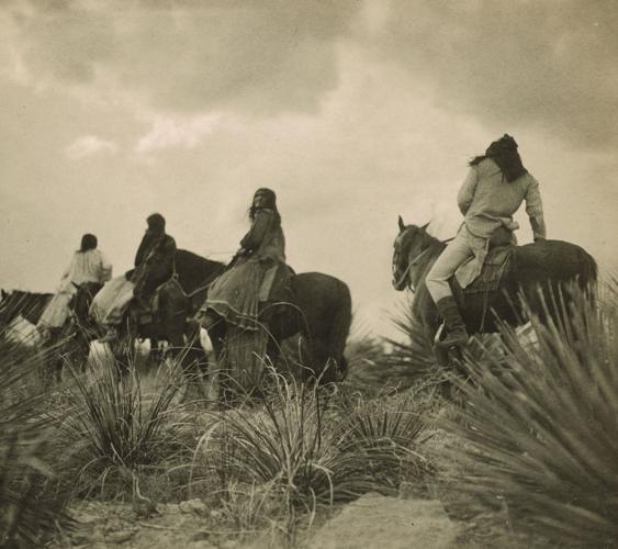
Creating a Historic Loss Assessment, Part 1: Native history and land dispossession

By calculating land dispossession, this report seeks to not only identify what has been taken from Native peoples but also how this theft became the original source of capital that built Colorado and the West.
Introducing the Historic Loss Assessment: Articulating lost lives, land, and resources for the Native Nations in your state
While much of settler colonialism’s harm to Native Nations is unquantifiable, assessments like this provide data that helps tell those Nation’s stories.