Bureau of Indian Affairs Budget by Categories
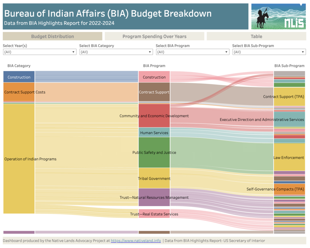
About this Dashboard This data dashboard summarizes data from the United States Secretary of Interior; it features the Bureau of Indian Affairs Yearly Highlights Reports, which show BIA spending by categories, programs and subprograms for years 2022, 2023, annualized CR (estimates) for 2024 and requested budget for 2025. We digitized these static reports in an […]
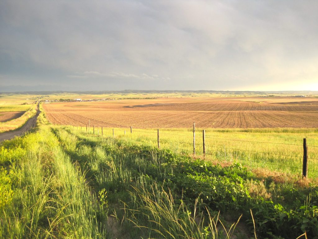
Creating a Historic Loss Assessment, Part 1: Native history and land dispossession
By calculating land dispossession, this report seeks to not only identify what has been taken from Native peoples but also how this theft became the original source of capital that built Colorado and the West.
Introducing the Historic Loss Assessment: Articulating lost lives, land, and resources for the Native Nations in your state
While much of settler colonialism’s harm to Native Nations is unquantifiable, assessments like this provide data that helps tell those Nation’s stories.
Energy & Mineral Revenue From US Native Lands (2008-2020)
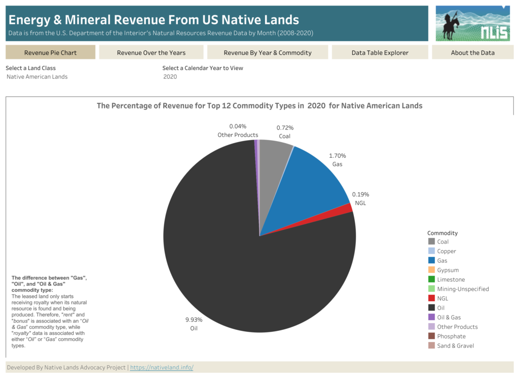
About this Dashboard This data dashboard, developed by the Native Lands Advocacy Project, summarizes data from the US Department of Interior’s Office of Natural Resources Revenue (ONRR) for US Native Lands for the period of 2008 through 2020. This dashboard also has the data for all federal lands. 0 Resource Types 0 Land Class 0 Years of […]
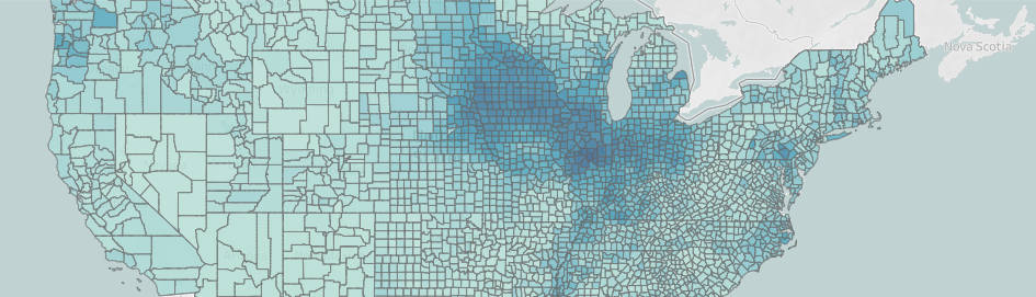
Reservation Croplands: How Native Farmers and Ranchers Can Leverage the USDA’s Cropland Data Layer for Land Planning
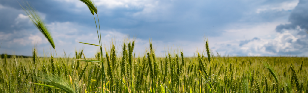
In 2022, there were about 110 million acres of cropland (5.7%) on Native American reservations (including on-reservation and off-reservation trust lands). What are these croplands and land covers? How have they changed over time? Why does this data matter?
NLAP Collaborates on Special Journal Publication About Tribal Data Sovereignty

NLAP and leading Indigenous scholars write about tribal data accessibility, equity, and sovereignty in “Life and Times of Data Access: Regarding Native Lands.”
Introducing New Resource Tools for Grassland Protection and Restoration
NLAP is happy to announce two new resource tools for grassland and biodiversity protection: our storymap, Grasslands: The Land and the People that Call it Home, and our Conservation Reserve Program Dashboard!
Announcing Our New Storymap: The Legacy of Allotment on Contemporary Native Agriculture
What did early reservation agriculture look like? What is the settler colonial myth, and how has it distorted the perception of Native agriculture? What is the historical legacy of allotment? How are Native communities actively resisting and healing from this legacy? The Native Lands Advocacy Project is thrilled to announce our newest storymap: The Legacy of […]
The Legacy of Allotment on Contemporary Native Agriculture
In this storymap, we explore recent data from the USDA Census of Agriculture for American Indian Reservations to illustrate the devastating and intergenerational impacts of the Dawes Act. Although we trace current disparities back to their roots in oppressive agricultural policies, Native communities across the country have been leading efforts to change the narrative.
Demographics Dashboard for US Native Lands
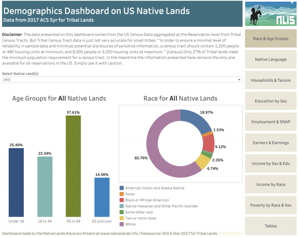
About this Dashboard This dashboard summarises data from the US Census ACS 5YR 2017, which aggregates for tribal geographies data collected by the Census at the Tribal Census Tracts-level. It allows to easily navigate key thematic information using the tabs menu. Raw Data available for download on the Tables Tab. 0 Native Land Areas 0 […]
Announcing Our New “Preserving Intact Habitat on Native Lands” Storymap!
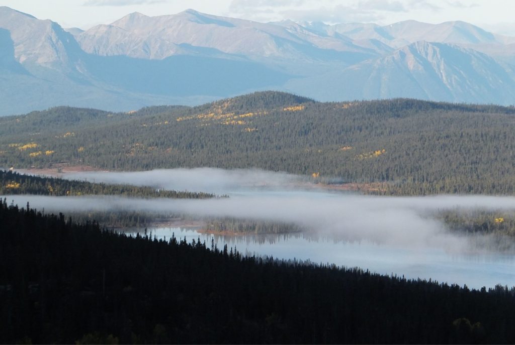
What is intact habitat, and why is it important? How has preserving intact habitat been the key to addressing tribal priorities? What resource tools exist for tribes to utilize in their own intact habitat planning? To help answer these questions and more, NLAP is happy to announce our new storymap, Preserving Intact Habitat on US […]
Announcing New Updates to Our National Land Cover Database Dashboard!
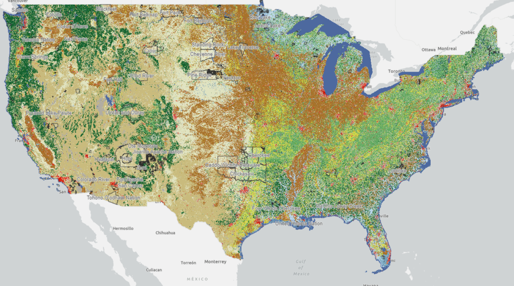
By Raven McMullin // April 18, 2022 NLAP remains committed to making available to Tribes, Native organizations, and land caretakers the most relevant and current data critical for Native land planning and research. In furtherance of this commitment, we are excited to announce new updates to our National Land Cover Database Dashboard (NLCD) along with a […]