Available Water in Soil on US Native Lands
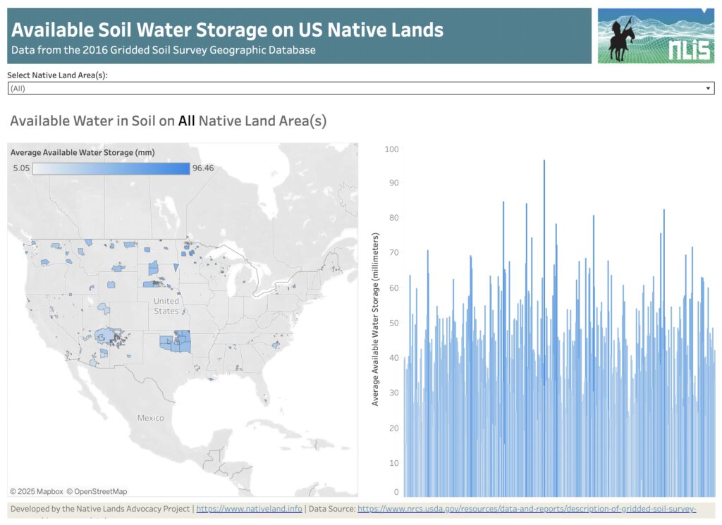
About this Dashboard This dashboard features a reservation-level view of the available water data in soil on all tribal lands in the US. Data comes from the USGS Gridded soil survey for 2016. The “available water in soil” variable from gridded soil surveys refers to the quantity of water that a soil can store and […]
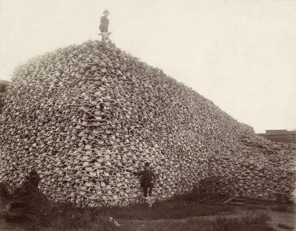
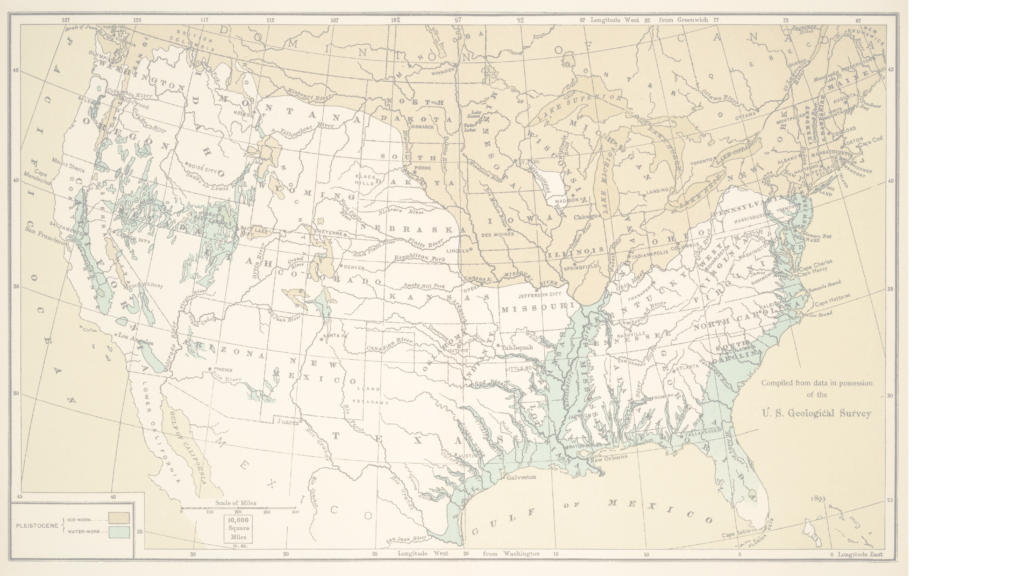
Creating a Historic Loss Assessment, Part 4: Extermination of buffalo and other significant losses
By calculating land dispossession, this report seeks to not only identify what has been taken from Native peoples but also how this theft became the original source of capital that built Colorado and the West.
Creating a Historic Loss Assessment, Part 3: Illegal settlements and loss of agricultural revenue

By calculating land dispossession, this report seeks to not only identify what has been taken from Native peoples but also how this theft became the original source of capital that built Colorado and the West.
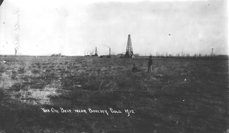
Creating a Historic Loss Assessment, Part 2: Loss of life and Extraction of minerals
By calculating land dispossession, this report seeks to not only identify what has been taken from Native peoples but also how this theft became the original source of capital that built Colorado and the West.
Announcing our Webinar Series: Keystone Data Tools for Native Land Planning

The Native Lands Advocacy Project (NLAP) is hosting a webinar series on three of our key data tools. Join these 45-minute webinars to learn about our Agriculture on Native Lands dashboard, Land Cover dashboard and map, and Cropland Data Layer dashboard! These free, public data tools are not only powerful for tribal planning on their […]
Creating a Historic Loss Assessment, Part 1: Native history and land dispossession

By calculating land dispossession, this report seeks to not only identify what has been taken from Native peoples but also how this theft became the original source of capital that built Colorado and the West.
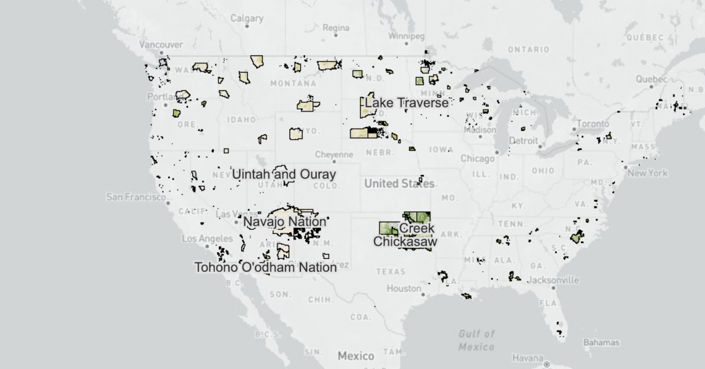
SSURGO Soil Classification Viewer for US Native Lands
This map shows the canopy cover percentages and land cover types on Reservations and USFS lands.
Introducing the Historic Loss Assessment: Articulating lost lives, land, and resources for the Native Nations in your state
While much of settler colonialism’s harm to Native Nations is unquantifiable, assessments like this provide data that helps tell those Nation’s stories.
Energy & Mineral Revenue From US Native Lands (2008-2020)
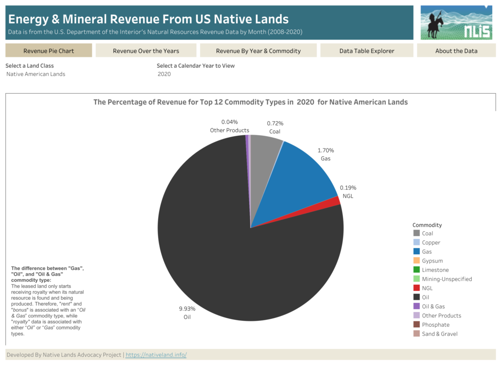
About this Dashboard This data dashboard, developed by the Native Lands Advocacy Project, summarizes data from the US Department of Interior’s Office of Natural Resources Revenue (ONRR) for US Native Lands for the period of 2008 through 2020. This dashboard also has the data for all federal lands. 0 Resource Types 0 Land Class 0 Years of […]
Environmental Risks for US Native Lands (Drought, Heat, Rain, Wildfire: 1980-2020)
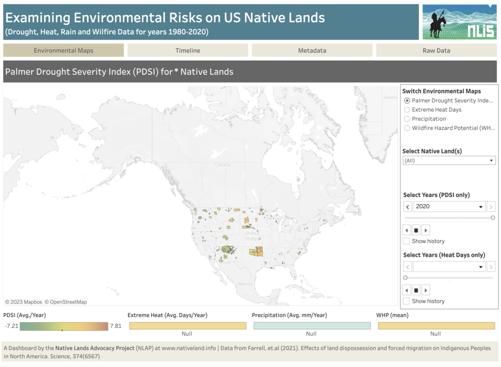
About this Dashboard This dashboard shows key environmental risks data for US tribal lands to help tribes monitor and assess risks and incorporate them in their land planning and decision-making. Data comes from the recent article: Farrell, J., Burow, P. B., McConnell, K., Bayham, J., Whyte, K., & Koss, G. (2021). Effects of land dispossession […]
Conservation Reserve Program
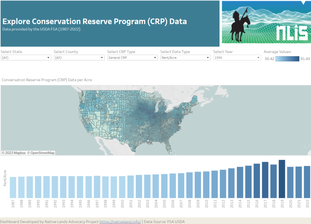
About this Dashboard This data dashboard summarizes data from the USDA FSA conservation reserve program (CRP) for every eligible county in the United States since the program’s inception in 1986 (data for years 1987-2022). The data in this dashboard shows state and county averages in addition to yearly enrollment and rent totals. Years of Coverage […]
Soil Organic Carbon for Land Planning on Native Lands
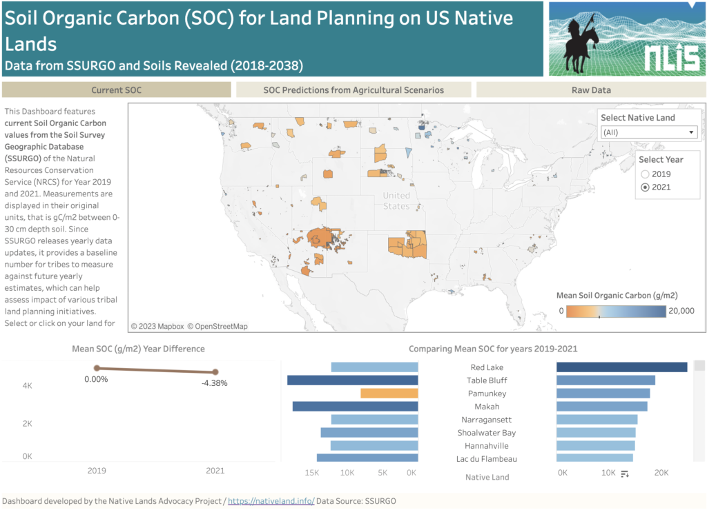
About this Dashboard This data dashboard summarizes past and present Soil Organic Carbon (SOC) data for all Native Lands but also future estimates depending on different agricultural scenarios. Data comes from the Soils Survey Geographic Database (SSURGO) for past and most to date available values (2019 and 2021). For future scenarios, we used estimates from […]