Keystone Data Tools for Native Land Planning: View the webinar recordings & share your feedback
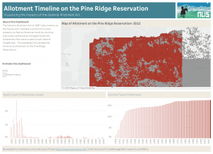
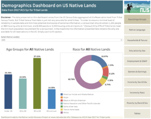
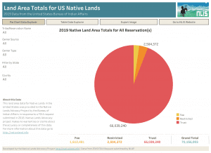
This month, the Native Lands Advocacy Project (NLAP) wrapped up our webinar series: Keystone Data Tools for Native Land Planning. These webinars introduced attendees to
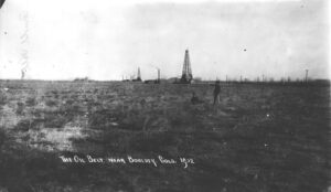
Creating a Historic Loss Assessment, Part 2: Loss of life and Extraction of minerals
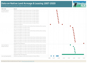
By calculating land dispossession, this report seeks to not only identify what has been taken from Native peoples but also how this theft became the original source of capital that built Colorado and the West.

Creating a Historic Loss Assessment, Part 1: Native history and land dispossession
By calculating land dispossession, this report seeks to not only identify what has been taken from Native peoples but also how this theft became the original source of capital that built Colorado and the West.
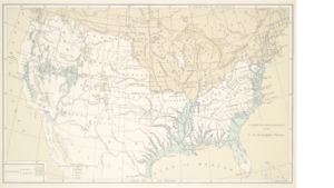
Introducing the Historic Loss Assessment: Articulating lost lives, land, and resources for the Native Nations in your state
While much of settler colonialism’s harm to Native Nations is unquantifiable, assessments like this provide data that helps tell those Nation’s stories.

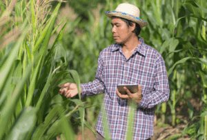
Reservation Croplands: How Native Farmers and Ranchers Can Leverage the USDA’s Cropland Data Layer for Land Planning
In 2022, there were about 110 million acres of cropland (5.7%) on Native American reservations (including on-reservation and off-reservation trust lands). What are these croplands and land covers? How have they changed over time? Why does this data matter?

NLAP Collaborates on Special Journal Publication About Tribal Data Sovereignty
NLAP and leading Indigenous scholars write about tribal data accessibility, equity, and sovereignty in “Life and Times of Data Access: Regarding Native Lands.”