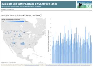
Available Water in Soil on US Native Lands
About this Dashboard This dashboard features a reservation-level view of the available water data in soil on all tribal lands in the US. Data comes
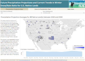
Precipitation Projections and Winter Trends on US Native Lands
About this Dashboard This data dashboard summarizes data from future precipitation predictions and historical changes in the snow-to-precipitation ratio on Tribal lands in the contiguous
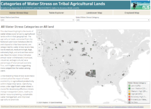
Agricultural Water Stress on US Native Lands
About this Dashboard This data dashboard summarizes data from the World Resources Institute, and the National Land Cover Database for Native Lands in the United
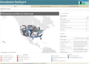
Ground Water on US Native Lands
About this Dashboard This data dashboard summarizes data from the National Ground-Water Monitoring Network, and the national datasets of principle aquifers and aquifers of alluvial
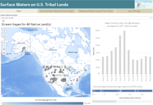
Surface Waters on Native Lands Dashboard
About this Dashboard This data includes the USGS’s National Hydrography Plus Dataset V2 (NHDPlus), released in 2012, and the 2021 TIGER Boundaries for U.S. American
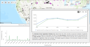
Water Quality Viewer – Pesticides
Explore pesticide concentrations in groundwater and surface waters, as well as estimated agricultural pesticide use, across US Native Lands with this interactive dashboard. Users can select specific Native Lands, filter data by pesticide, year range, and water type, and visualize trends in pesticide concentrations and use. The dashboard includes both monitoring-level data from water-quality stations and county-level pesticide use estimates, providing a comprehensive view of pesticide impacts on these vital ecosystems.

Water Quality Viewer – Temperature
Explore the local temperature measurements across groundwater and surface waters of US Native Lands with this interactive dashboard. Users can select specific Native Lands, filter data by month and year range, and visualize trends to better understand local temperature changes in these vital ecosystems.
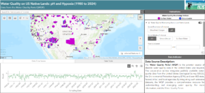
Water Quality Viewer – pH and Hypoxia
Explore the pH and dissolved oxygen levels across groundwater and surface waters of US Native Lands with this interactive dashboard. Users can select specific Native Lands, filter data by parameter and year range, and visualize trends to better understand hypoxia and water quality in these vital ecosystems.
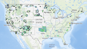
Culvert Condition Viewer
Explore Tribal Lands in the lower 48 states with this interactive map, showcasing culvert conditions and National Bridge Inventory (NBI) ratings to support environmental analysis and decision-making.
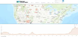
Elevation Profile Explorer
Welcome to the Elevation Profile Explorer, a powerful tool designed to help you understand the terrain and elevation changes across Native lands in the United States.

Water is Life: Native Efforts to Restore Water Systems
Native American efforts to protect our water systems are integral to the restoration and preservation of this non-human relative.

Empowering Tribal Climate Adaptation Through Data
Learn more about the first-of-its-kind Climate Data Portal for US Native Lands—designed to strategically support tribal climate planning.
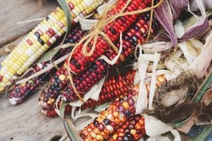
Sustainable Food Systems for US Native Lands: A Story Untold
The myth of an “empty land” where Natives lived idly without making good use of their natural resources is persistent and served as the primary base to justify taking lands away from tribes. Contrary to stereotypes, Native Agriculture was diverse and flourishing prior to settler colonialism.