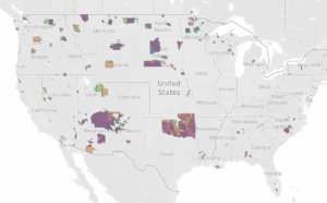
What is the Food System Transition Index for U.S. Native Lands?
The Food System Transition Index (FSTI) is a first-of-its-kind tool specifically designed for U.S. Native lands. The FSTI compiles key indicators inherent to a healthy food system from a holistic indigenous approach. Here, you will find information connecting different aspects of food sovereignty, such as agricultural land use, land sovereignty, health, healthy food access, and the climate impact of food production. The Index provides a ranking designed to foster local and intertribal collaboration in food-system management and planning.
What's in the FSTI?
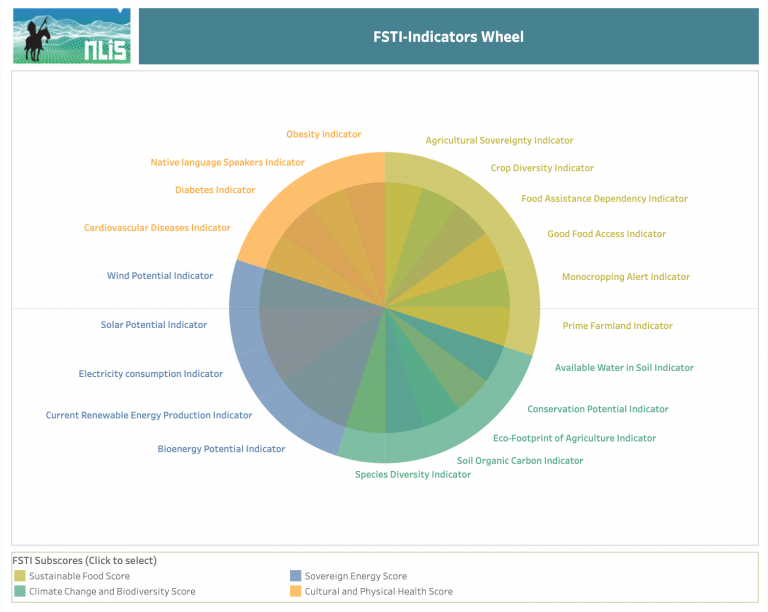
The Food System Transition Index is an aggregate measure from 20 complementary indicators to support sustainable and healthy food-systems on U.S. Native lands. The Index brings together key dimensions of sovereign, sustainable, indigenous food-systems identified by Native food scholars and defined by practitioners. It opens new doors for sustainable land planning and food-systems management on Native lands, using a holistic Native approach. This work was made possible through funding from the Indian Land Tenure Foundation.
To build the Index, 20 indicators were narrowed down to four distinct subscores:
- Sustainable Food
- Climate Change and Biodiversity
- Sovereign Energy
- Cultural and Physical Health
Each indicator was carefully selected for its capacity to:
- Measure a key dimension within the four subscores
- Contribute to telling the story of interconnected food-systems
The final Index follows the structure below:
How Does the FSTI Work?
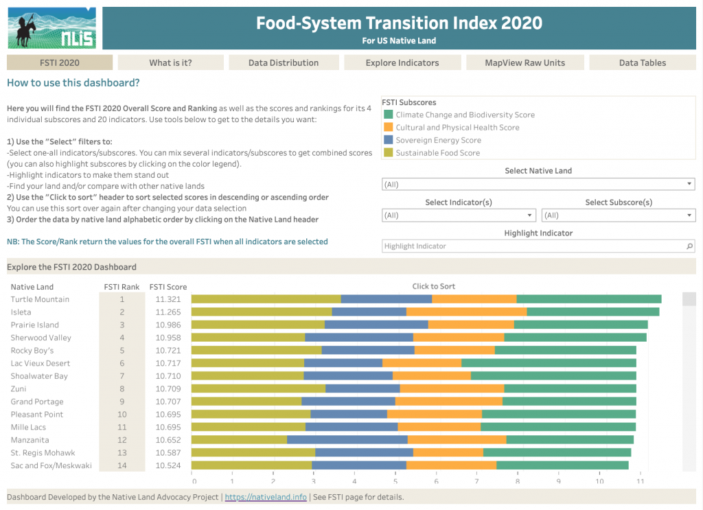
- Access the FSTI main page and click on the dashboard to explore the Index
- Use the tabs to navigate the different data views
- Sort the views as needed by using the available filters
- Download particular views as images, PDFs, or Tableau workbooks in the dashboard itself
- Navigate the main page to learn more about the FSTI methods and vision
Stay Tuned: the NLIS Will Soon Release the Raw Data of the FSTI Indicators Land Planning!
The Index compiles 20 indicators, most of which were especially designed for this project to best fit the specific needs of U.S. Native lands and to support long-term sovereign and sustainable land planning. The Index itself is an aggregated scaled measure, which is very useful to cross-compare ranking between indicators and between reservations. However, each indicator also deserves to be presented in its raw unit and in a disaggregated form so it can be used locally to set benchmarks and goals for local land-planning. The NLIS project is planning to release individual dashboards containing this information and more specific indicator-focused analysis. We already released a dashboard for the Good Food Access Indicator. Stay tuned for our upcoming individual dashboards' release!


