These Water-Focused Data Tools Support Tribal Land & Climate Planning

The Native Land Information System (NLIS) is home to over 120 public, free data tools and resources that were created to support tribal communities in developing climate-smart land management strategies. We are excited to share some of our new water data tools with you, as well as reintroduce you to some of our earlier water-related […]
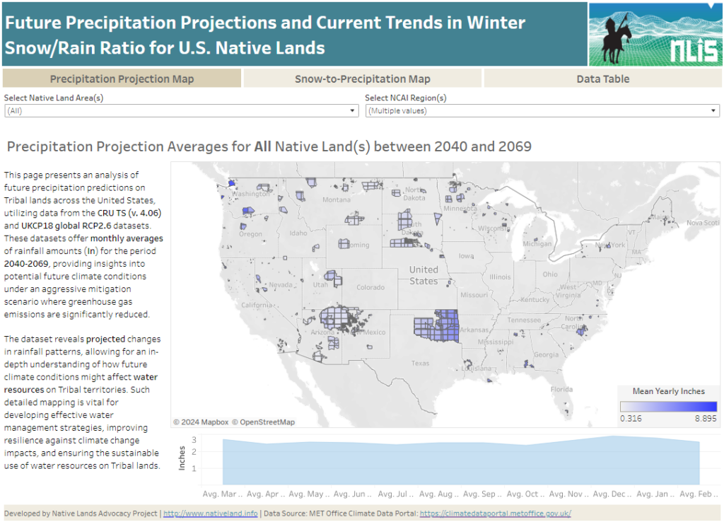
Precipitation Projections and Winter Trends on US Native Lands

About this Dashboard This data dashboard summarizes data from future precipitation predictions and historical changes in the snow-to-precipitation ratio on Tribal lands in the contiguous United States. The precipitation predictions are based on datasets from the CRU TS (v. 4.06) and UKCP18 global RCP2.6 scenarios, while the snow-to-precipitation ratio data comes from 177 weather stations […]
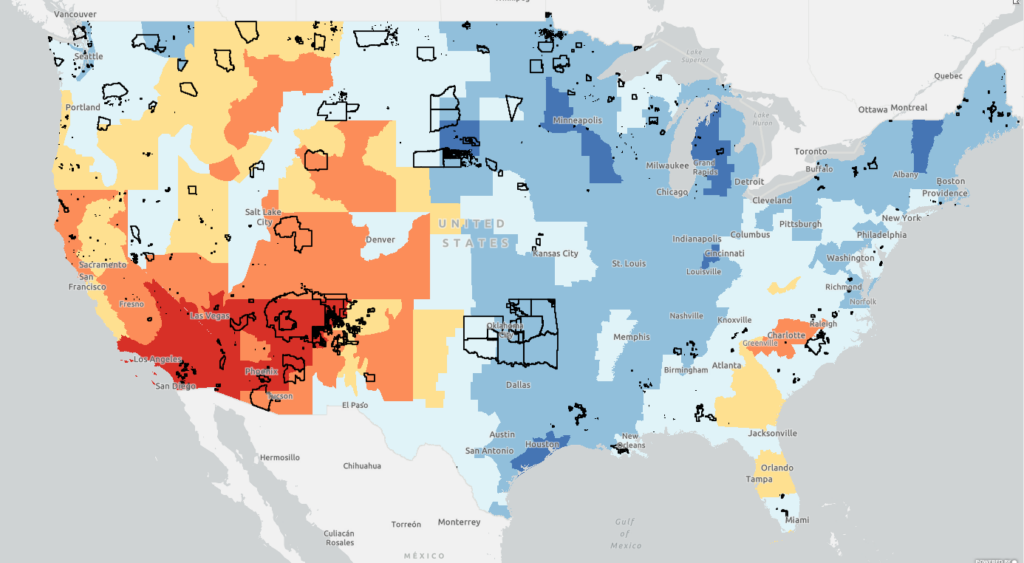
Change in Rain & Snow Patterns on U.S. Native Lands

This map displays data layers based on the EPA’s Climate Change Indicators in the United States report, specifically focusing on Change in Rain & Snow Patterns on U.S. Native lands. On this map, view layers related to change in snowfall, precipitation, snow-to-precipitation ratio, and April snowpack in western US.
