What is intact habitat, and why is it important? How has preserving intact habitat been the key to addressing tribal priorities? What resource tools exist for tribes to utilize in their own intact habitat planning?
To help answer these questions and more, NLAP is happy to announce our new storymap, Preserving Intact Habitat on US Native Lands. This storymap was born out of a need for tribal access to the data and planning tools necessary to protect precious non-human relatives. These tools may also serve to ensure greater tribal resilience to infrastructural and climate changes.
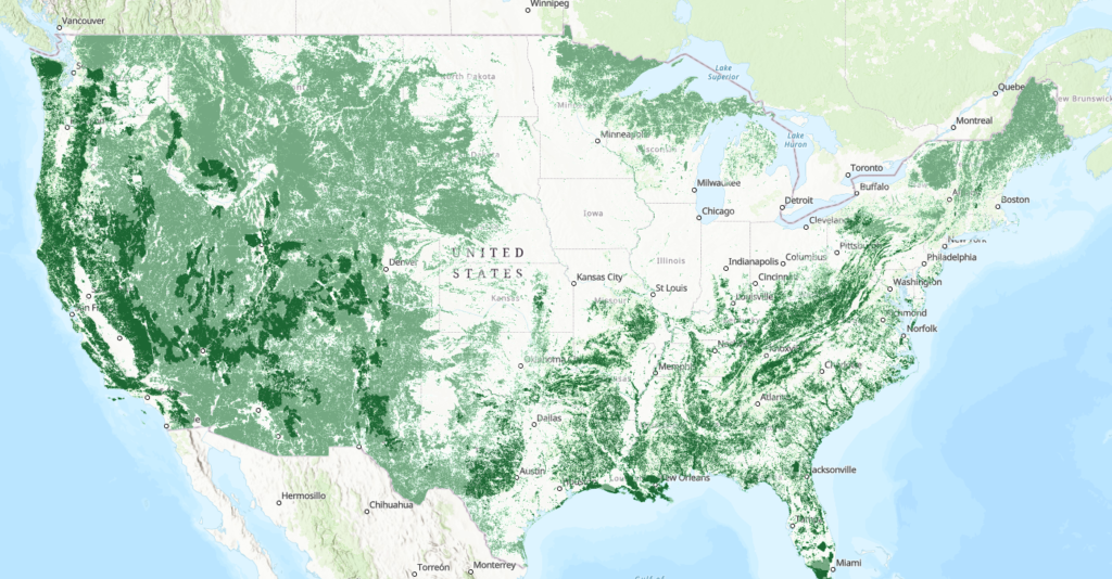
As you scroll through the storymap, you will see the intact habitat cores and planning tools supported by Esri’s Green Infrastructure Initiative. By this initiative, which provides public access to key habitat core layers, NLAP was able to create our own web application for Tribes to identify intact habitat cores on their own lands!
Exciting Features
Here are some of the key components of the new storymap:
- A walk-through of tribal intact habitat planning and historic preservation
- Features of Esri’s incredible planning tools that tribes can integrate into their own intact habitat planning, plus, a “how-to” of their Intact Habitat Cores map
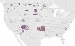
- Step-by-step demos of our ‘Intact Habitat on US Native Lands’ map!
For tribal communities, maintaining connection between natural spaces preserves Native peoples’ relationships to the land. Therefore, in this interactive storymap, we will walk through the importance of habitat connectivity for Native lands, approaches to promoting habitat connectivity provided by Esri, and how different data tools—one of which being our very own intact habitat layer—may be used for tribal protection of their homelands and non-human relatives.
- Preserving Intact Habitat on Native Lands Storymap
A Comment on Biodiversity Assessment: Key Biodiversity Areas (KBAs) and Intact Habitat
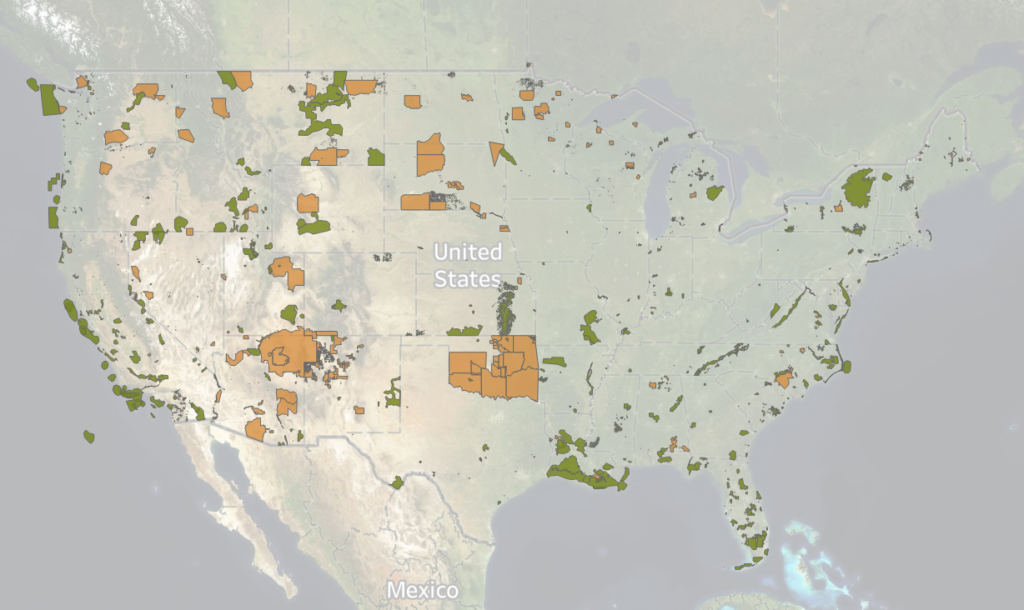
NLAP recognizes the importance of protecting biodiversity and intact habitat, especially in the face of global climate change and related commodification of the Earth’s remaining natural resources. While intact habitat is the approach we advocate for when it comes to assessing biodiversity on US Native lands, NLAP also recognizes another widely-known approach: the Key Biodiversity Area (KBA) Database. KBAs, championed by the KBA Partnership founded in 2016, feature areas considered important for conservation and are identified and collected at the national level by National Coordination Groups (NCG). KBAs are considered the global standard for identifying important habitats.
However, after researching the distribution and creation of KBAs in North America and their overlap with reservation territories, NLAP found that, up until this point, there has been little to no consultation with tribes. This means that KBA maps do not include the important habitats identified on Native lands. While the forming National Coordination Group for the United States promises to involve (some) indigenous voices, it is unlikely that they will consult with each tribe on the KBA selection process. In waiting for the KBA inclusion process to unfold, tribes still need access to unbiased resources and data for land decision-making.
Recognizing the importance of identifying and protecting important habitats, NLAP makes the intact habitat preservation tools and resources profiled in this storymap available to tribes as an alternative to KBAs. Unlike KBAs, the intact habitat data is based only on the data for land cover, hydrography, biodiversity, and threatened species – not politics. As such, NLAP believes this data can be used by tribes to support their longstanding Traditional Ecological Knowledge (TEK) and community values and priorities. Furthermore, by identifying their own areas of priority, tribes can choose whether they want to share those maps with the public or the KBA Partnership– maintaining their sovereign right to execute land-caretaking decisions however they see fit.

