The Native Lands Advocacy Project (NLAP) is pleased to highlight The Impact Project, an initiative that shares many of our values and has the potential to empower informed tribal decision-making in the midst of a turbulent federal landscape.
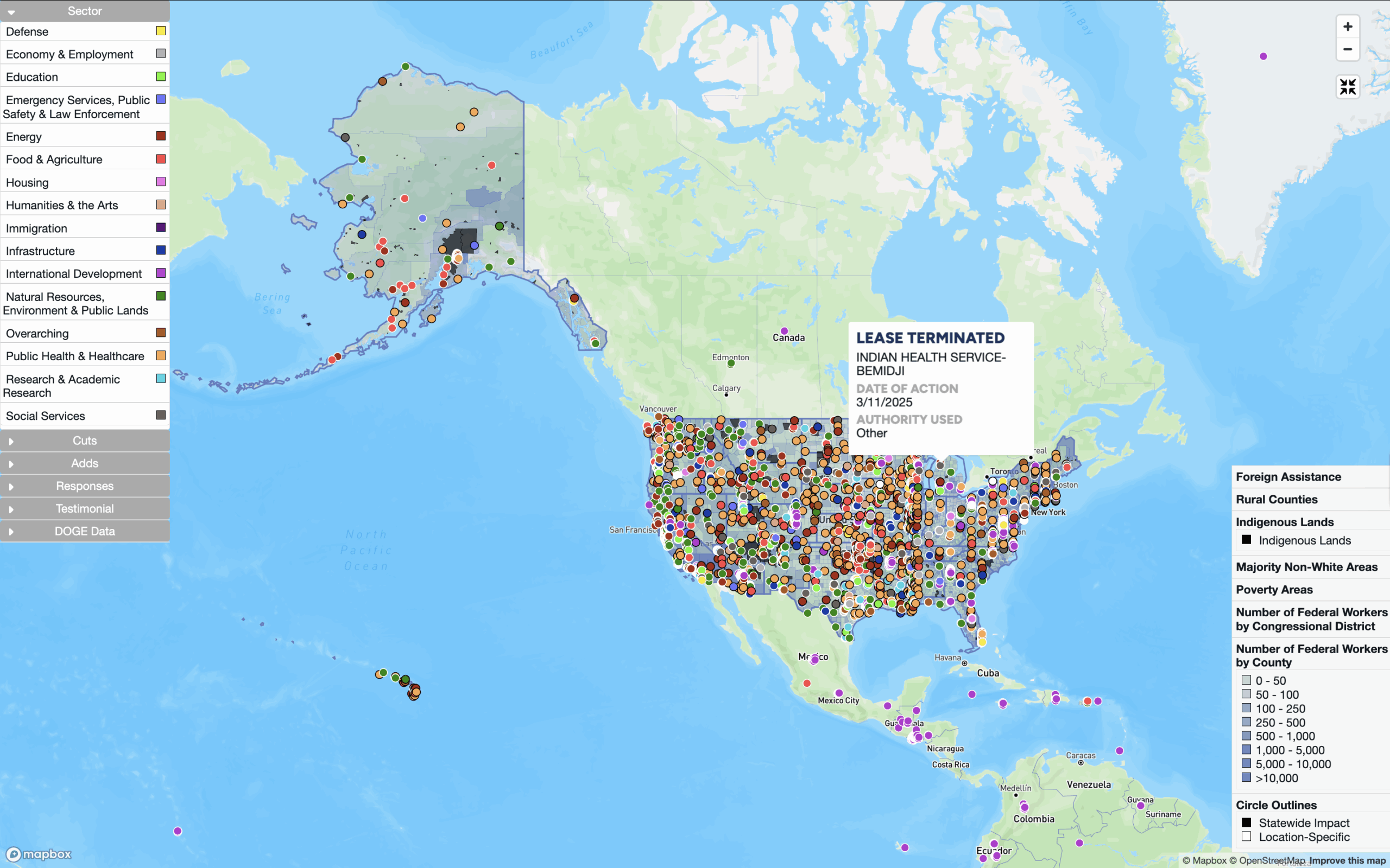
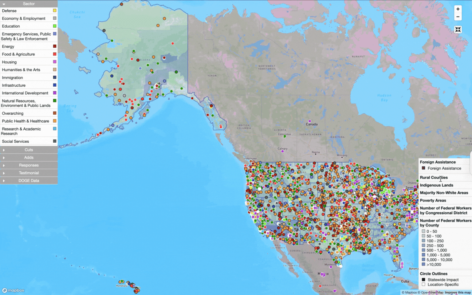
The Impact Project, founded by Abigail André, builds open-source data tools to help users understand how current federal changes impact local communities. The project’s first tool, the Impact Map, uses vetted data from newspaper articles, government sources, and direct testimonials to map changes—including but not limited to grant cancellations, lease terminations, and federal employee firings—to localize and humanize the results of these complex federal decisions. See an image of the Impact Map below.
“From workforce shifts to public health to disaster response, these policies aren’t abstract—they shape our lives,” André shared in a recent LinkedIn post.
The Impact Project is non-partisan, and in their FAQs they elaborate: “Our goal is to present data as clearly and transparently as possible, with full visibility into our sources, so people can draw their own conclusions. We believe that objective, widely accessible, and well-sourced information is essential for understanding how government decisions impact our communities.”
The Impact Project’s Relevance to Indian Country
NLAP was founded on the understanding that access to transparent and relevant public data is critical for sovereign tribal decision-making. As articulated in our statement on data sovereignty, “We believe the Federal Government has a moral and fiduciary obligation to provide data to tribes, especially data that can be used to assess its performance as self-appointed Trustee.” But this obligation is often not adequately met, and tribes continue to face major data hurdles when planning for the long-term health of their communities, lands, and resources.
These challenges can be further compounded by the ever-changing political climate in the United States, and the fact that most people, including public servants, have a limited knowledge of tribal law and Native land tenure, resulting in differing interpretations of the federal trust responsibility. In a fluid and rapidly changing federal landscape, it’s critical that tribes are able to identify, assess, and quantify the current and potential impacts of federal policies on their activities. Being equipped with this knowledge empowers tribes to better advocate for themselves and make informed plans for the future.
As the most comprehensive and up-to-date resource for tracking the real-time effects of federal policies on local communities, the Impact Map can help equip tribes with this much-needed knowledge and save both time and money for Native decision-makers.
How can Native Nations & citizens use the Impact Map?
While Native Nations already feel the impact of federal policy changes, the Impact Map can act as a resource to help their communities identify, document, and quantify those impacts for planning and advocacy purposes. Features of the map include:
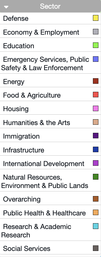
- Events: each data point represents an individual event (e.g. firing, funding cancellation, lease termination) color-coded by sector.
- Geographic overlays: optional layers displaying rural counties, poverty areas, reservation lands, etc., which allow users to gain more specific insights about communities or land areas of concern.
- Filters: in addition to being able to filter by sector, users can also filter by government actions (e.g., firing, rehiring, funding freeze), to include or exclude DOGE data (relevant because there are questions about this data’s reliability), and to prioritize data points that include personal testimonials (more on this below).
- Dashboards: see detailed data based on geography (currently U.S. states and territories, with plans for a Tribal Nations dashboard to come in the future), impact by type (e.g. impact on federal workers), and programmatic impacts (e.g. Americorps). A notable and relevant new addition to the Impact Project’s dashboards is the Budget section, which presents current data for the proposed fiscal year 2026 federal budget.
Identifying impacts on Native lands
The U.S. government’s responsibility to support Native food systems is grounded in treaties, federal law, and the trust responsibility (The Face of Disruption, n.d.). Nevertheless, in recent months, Tribal Nations have experienced significant disruptions to their food systems due to federal policy changes.
"The recent budget cuts by the USDA are disrupting tribal food systems, halting distribution programs, stalling efforts to expand Native food production, and undermining key partnerships. Native communities are working to feed their elders, children, and neighbors, yet they continue to face systemic neglect and policy failures. As tribal nations transform outdated, stigmatized food bank models into culturally relevant spaces, the very resources meant to support these initiatives are being taken away. Rather than investing in tribal food sovereignty, policymakers are withdrawing funding at a time when food insecurity is rising, and the cost of living continues to increase."
First Nations Development Institute
One of these budget cuts involved the discontinuation of the Local Food Purchase Assistance Cooperative Agreement Program (LFPA). The LFPA allowed “states, tribes and territories to procure and distribute local and regional foods and beverages that are healthy, nutritious, unique to their geographic areas and that meet the needs of the population” (Local Food Purchase Assistance Cooperative Agreement Program, n.d.). The ability to procure local and culturally relevant foods is especially critical for Tribal Nations, for whom colonial expansion, removal and relocation, forced cultural assimilation, and ecological damage have disrupted—and even violently severed—traditional food relationships.
The discontinuation of LFPA made headlines with a $1 billion national figure, but how does its cancellation affect tribal communities?
The GIF below shows how users can view these USDA funding cuts at the local level by using the Impact Map.
The Alutiiq Tribe of Old Harbor (highlighted above), like many Native communities in Alaska, is in a remote and rural area with limited access to groceries (Alutiiq Tribe of Old Harbor LFPA Plus Executive Summary, n.d.). The Impact Map shows that $195,516 of LFPA funds have been cut for this community, and while this could be seen as a small drop in the bucket of the $1 billion national figure, the importance of these funds for tribal food sovereignty, community health, cultural vitality, and economic development cannot be understated.
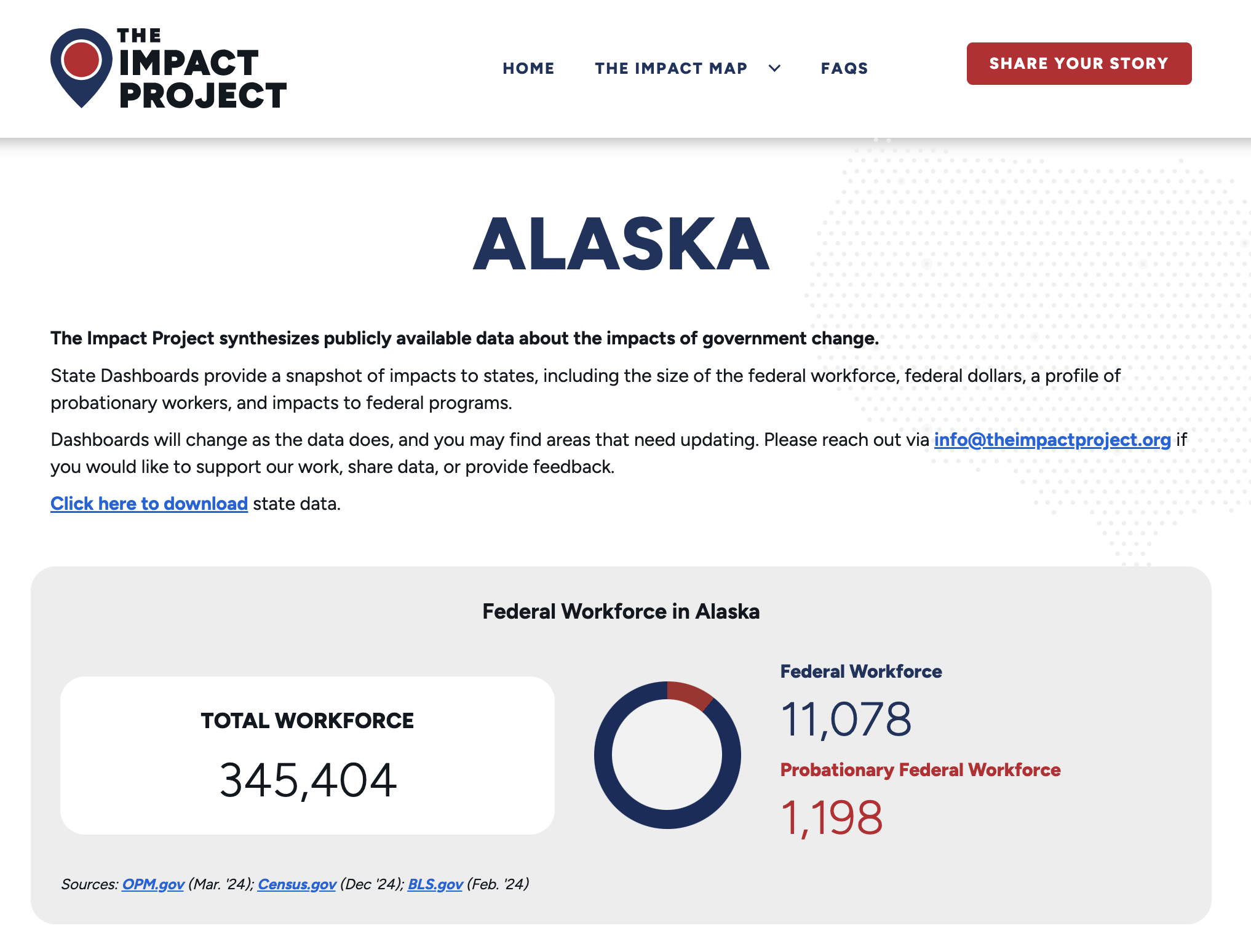
In Alaska alone, the Impact Map shows over $6.5 million ($6,587,961) of discontinued LFPA funds for Tribal Nations.
Left: an image of the Impact Project’s Alaska dashboard, which highlights state-specific insights about the impact of federal policies. Users can also download the full dataset to explore for themselves.
The example above highlights a simple way that Tribal Nations and citizens can use the Impact Map to identify and quantify impacts on their lands. However, Tribal Nations are affected by federal policies in a myriad of cross-cutting ways. Using the Impact Map, Native users can explore not only data points on their own geographies, but also regional and statewide policies, allowing them to assess and plan for the impacts that large programmatic changes may have on their communities.
Submit your Impacts to the Impact Project
The Impact Project is reliant on reporting—via news articles, government sources, and direct submissions—to stay up-to-date and accurate. If you or your Tribal Nation are experiencing impacts not represented by the map, consider submitting them using the forms below. The map is also currently in beta, and the Impact Project welcomes feedback.
Author
Written by Emma Scheerer
Works Cited
Alutiiq Tribe of Old Harbor LFPA Plus Executive Summary. (n.d.). Agricultural Marketing Service | United States Department of Agriculture. Retrieved July 28, 2025, from https://www.ams.usda.gov/selling-food-to-usda/lfpacap/plus/signed-agreements/alutiiq
Data Sovereignty. (n.d.). Native Land Information System. Retrieved July 28, 2025, from https://nativeland.info/about/data-sovereignty/
Heath, B., Reid, T., & Heath, B. (2025, March 5). DOGE website offers error-filled window into Musk’s government overhaul. Reuters. https://www.reuters.com/world/us/doge-website-offers-error-filled-window-into-musks-government-overhaul-2025-03-04/
Local Food Purchase Assistance Cooperative Agreement Program. (n.d.). Agricultural Marketing Service | United States Department of Agriculture. Retrieved July 28, 2025, from https://www.ams.usda.gov/selling-food-to-usda/lfpacap
The Face of Disruption: Impacts of USDA Funding Cuts on Tribal Food Systems. (n.d.). First Nations Development Institute. Retrieved July 28, 2025, from https://www.firstnations.org/news/the-face-of-disruption-impacts-of-usda-funding-cuts-on-tribal-food-systems/
The Impact Map. (n.d.). The Impact Project. Retrieved July 28, 2025, from https://theimpactproject.org/the-impact-map/
What is the federal Indian trust responsibility? (n.d.). Bureau of Indian Affairs. Retrieved July 28, 2025, from https://www.bia.gov/faqs/what-federal-indian-trust-responsibility