Agricultural Water Stress on US Native Lands
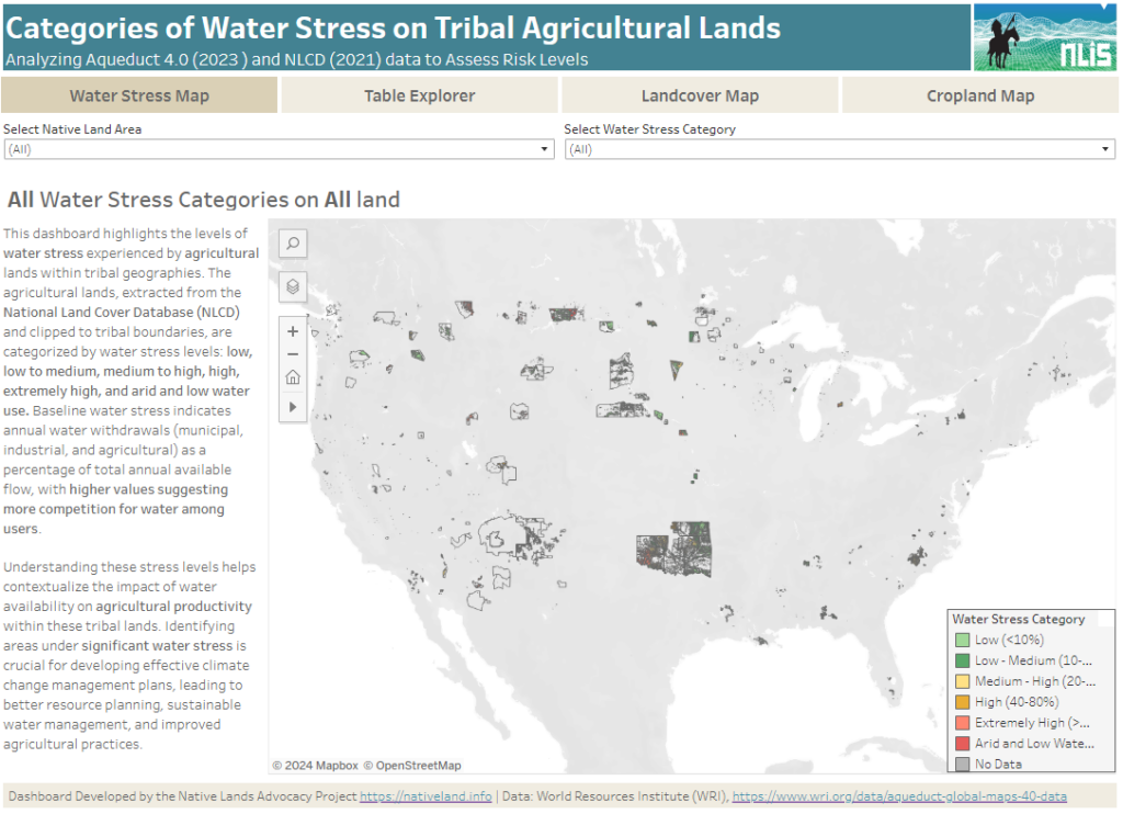
About this Dashboard This data dashboard summarizes data from the World Resources Institute, and the National Land Cover Database for Native Lands in the United States. It highlights the distribution and impact of water stress on agricultural lands within Native boundaries. The dashboard features detailed maps and interactive elements, allowing users to explore different water […]
US Drought Monitor (Google Earth Engine)
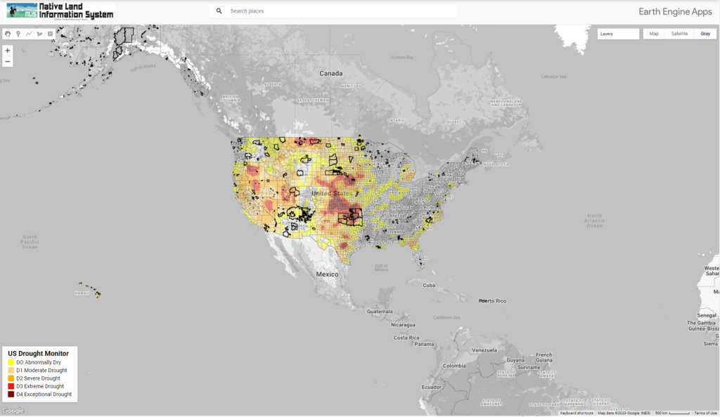
This map displays US Drought Conditions updated every Thursday as reported by National Drought Mitigation Center (NDMC)