The Pine Ridge Land Information System (PRLIS) is a web-based land information system designed to assist members of the Oglala Sioux Tribe to access information about their lands and resources. The PRLIS was developed Village Earth (a 501(c)(3) not-for-profit in partnership with the Oglala Sioux Tribe Land Office and made possible with support from the Indian Land Tenure Foundation.
The PRLIS makes it possible for members of the Oglala Sioux tribe to:
To request a specific layer, contact the NLAP info@nativeland.info.
With this information, land owners are empowered to better monitor and make informed decisions about the management and control of their lands. For more information about the options available to Lakota land owners such as writing a will, land exchange and consolidation, appraisals, gift deeds, right-of-way, and more visit: “Cutting through the Red Tape,” an online resource information resource developed by the Indian Land Tenure Foundation and Village Earth.
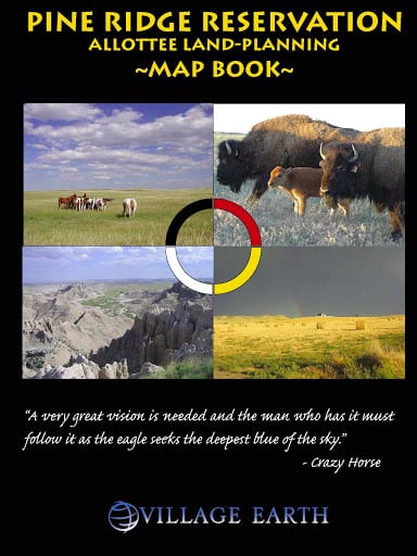
Download the Pine Ridge Allottee Land Planning Map Book developed in 2008 with support from the Indian Land Tenure Foundation as a planning tool for native land owners on the Pine Ridge Reservation. The map book contains detailed instruction for performing various land management functions including reading your individual trust interest report, locating your lands, exploring the various options that exist for managing your lands such as removing it from the BIA Range Unit Leasing System, consolidation, partitions, gift deeds, and more, and contains sample applications and relevant resolutions. The map book also contains a gazetteer style map and index where you can locate your lands using the Tract ID.
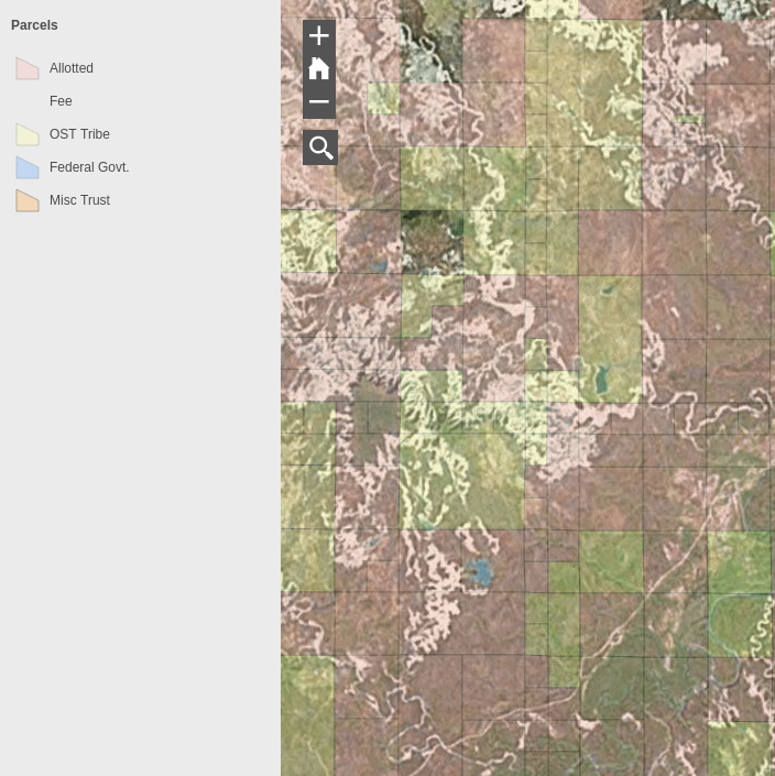
The parcel layer is from 2010 and maintained by the BIA. It is symbolized based on majority ownership. Pink for allotted lands (lands with majority ownership held by individual American Indians, brown for lands where the Oglala Sioux Tribe holds majority ownership and blue indicates lands that have a fee simple title. These lands, some of the most productive farm lands on the Pine Ridge, were originally allotted to individual members of the tribe but were quickly alienated through a process called forced fee patenting and sold to settlers through known as Fee Patenting,
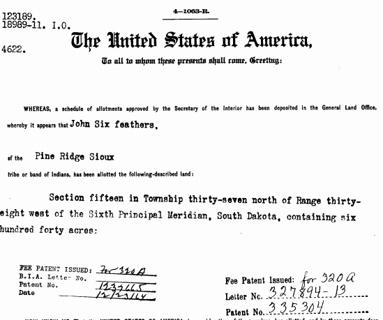
The PRLIS “Parcel Layer” links to the Bureau of Land Management’s Land Patent Database. This functionality is valuable for members of the Oglala Sioux Tribe who are trying to figure out when their allotted lands were originally issued to their ancestors and in particular, when their allotted lands were converted to fee-simple status and liquidated. This is the first step to uncovering why certain lands were “fee-patented” and liquidated.Village Earth and the LLRP believe the injustice and inter-generational affects of forced-fee patenting must be researched and exposed. This resource is major step forward toward this goal.
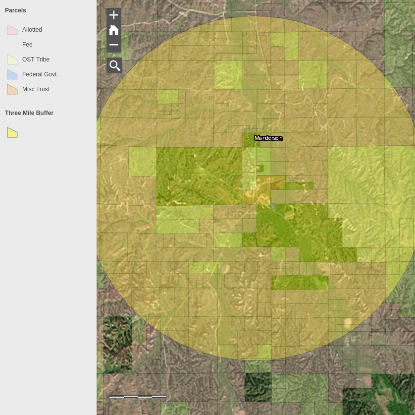
The PRLIS includes a layer that includes a three-mile buffer around the major towns on Pine Ridge. This information is valuable for Tribal members wanting to exchange their fractionated interests of land for a contiguous piece of Tribal land. According to Tribal Ordinance 85-17, Tribal land cannot be exchanged if it is surrounding the townsite of Pine Ridge and the established villages within a radius of 3 miles of such settlements.
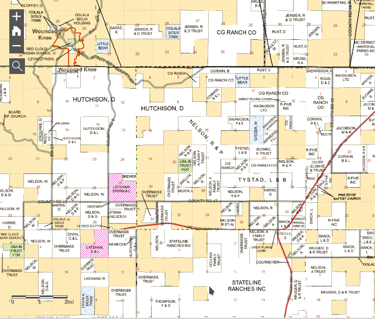
Access seamless 2017 county plat maps for Oglala Lakota, Jackson and Bennett Counties, the three counties that make-up the Pine Ridge Reservation. The maps show ownership information for “fee” or “deeded” lands within the boundaries of the Pine Ridge Reservation. The liquidation of allotted lands began with the the Burke Act of 1906 which authorized the secretary of Interior to remove trust protections and issue fee patents to Native Americans that are considered “competent”. While the practice of forced-fee patenting was supposed to end with the Wheeler-Howard Act the secretary of interior still had the power to issue fee patents to individual land owners upon petition. During the post WWII relocation era where federal policy shifted to encourage Native Americans to move off Reservations and a fill the growing need for wage laborers in urban areas of the United States, the BIA approved almost all requests for fee patents.
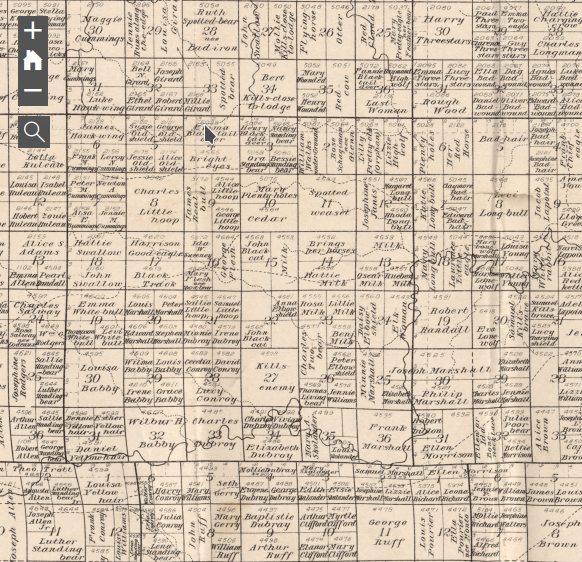
This “pocket map” was developed by Charles H. Bates to advertise lands on the Pine Ridge Reservation opened up to homesteaders through the Act of May 27th, 1910. If you zoom-out far enough the left side margin of the map includes the original covers with description of the opportunity to access “thousands of acres of the richest portion of Pine Ridge Reservation”. This act was rescinded by secretarial order June 10th, 1936 which put a stop to the sale of all “undisposed-of surplus opened lands of the Pine Ridge Reservation.”
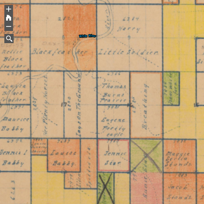
This is a digitized and georectified version of the original allotment map of the Pine Ridge Reservation. The map contains the original allotments along with the names of the original allottees as well as hand drawn notes and color-coding to designate different classes of lands. Until now, this information was not available to members of the tribe and over the years, many people have asked us to try get this information for them so they can can begin to reconstruct the history of their lands, especially lands liquidated by the Federal Government through a process known as forced fee patenting. The creation and issuing of allotments began on the Pine Ridge Reservation in 1904, under Executive Order of July 29, 1904 and continued until 1923. During this period, government officials carved up the Reservation into parcels and issued them to Lakota families.
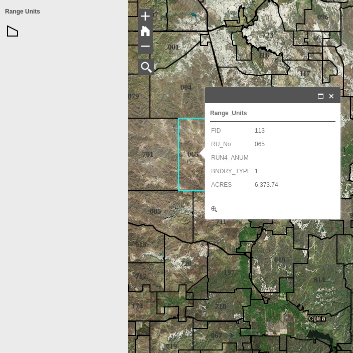
Range units are defined areas of land on Native Americans that are leased, in many cases to non-Natives by the Bureau of Indian Affairs (BIA) for farming, ranching and other purposes. The BIA then distributes a portion of the revenue collected from those lands to the hundreds or thousands of individual Native American and Tribal government who own interests in lands within each range unit. (Read history here) According to the USDA 2012 Census of Agriculture for American Indian Reservations, the market value of agriculture commodities produced on the Pine Ridge Reservation in 2012 totaled $87 million. Yet, less than 1/3 ($24 million) of that income went to Native American producers.