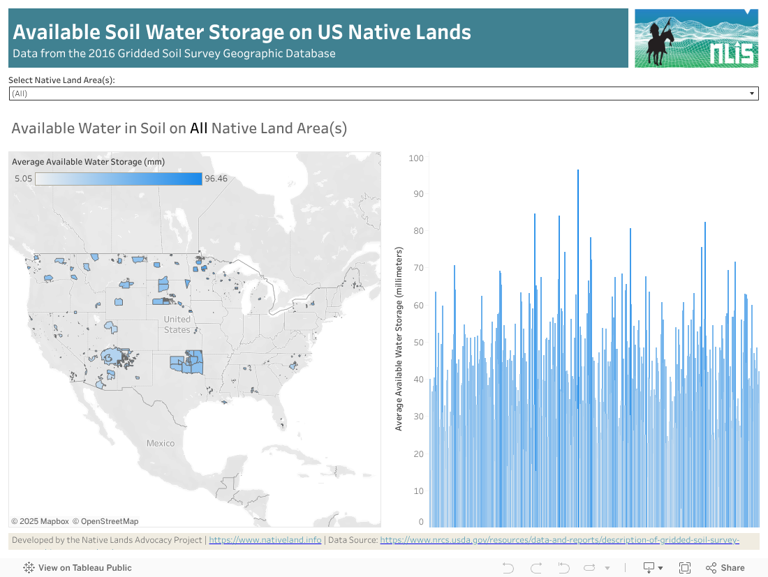
This dashboard features a reservation-level view of the available water data in soil on all tribal lands in the US.
Data comes from the USGS Gridded soil survey for 2016. The “available water in soil” variable from gridded soil surveys refers to the quantity of water that a soil can store and make available for plant use, often termed Available Water Capacity (AWC) or Available Water Storage (AWS). This is calculated as the difference in soil moisture between field capacity (the maximum amount the soil can hold after excess water has drained away) and the permanent wilting point (the minimum amount needed for plants to survive), adjusted for soil texture, organic matter, bulk density, rock fragments, and other properties.
Understanding how water behaves on the land and interacts with the soil is paramount to quality land use. And such analysis has never been made available to all tribes for native land management purposes. The possible uses of this data include:
Crop and Plant Selection: Farmers and planners use AWC data to select crops that match the soil’s capacity to store and deliver water, optimizing yield potential and sustainability.
Irrigation System Design: The data helps design efficient irrigation systems, identify water-limited areas, and reduce over-irrigation or water waste.
Erosion and Runoff Management: Understanding water holding capacity aids in predicting runoff and erosion risk, guiding the placement of buffer zones and conservation structures.
Urban and Infrastructure Planning: Planners assess suitability for construction, landscaping, and drainage design, ensuring stable foundations and resilient green spaces.
Environmental Assessment: Evaluates groundwater recharge potential, wetland restoration feasibility, and resilience to drought or flood conditions.
Land Use Evaluation: Contributes to holistic land-use planning, zoning, and environmental impact assessments, helping balance agricultural, urban, and conservation needs.
In summary, available water in soil data from gridded surveys is essential for agricultural management, environmental conservation, and sustainable land development, providing a scientific basis to align land planning decisions with soil and water resource capacity
While this dashboard offers valuable insights into wind speed patterns across Native lands, there are several limitations and considerations to keep in mind. Data is only provided at the reservation level, which is useful for tribal-level management and to evaluate the impact of tribal policies. However, it is limited for use by individual farmers and ranchers. We can provide more granular-level analyses on demand. Feel free to reach out for more information
Data for this dashboard can be downloaded from the dashboard itself on the bottom right corner. For more granular data, please contact us directly.