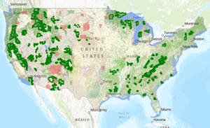
Forest Lands Viewer
This map shows the canopy cover percentages and land cover types on Reservations and USFS lands.
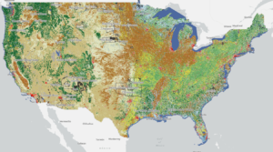
National Land Cover Database: Tribal Lands Viewer
This map viewer visualizes every available year of the National Land Cover Database (NLCD) and makes it possible to filter for 848 native land areas (reservations and off reservation trust lands) in the United States for 2001 and 2019.
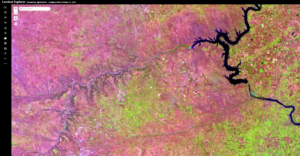
ESRI Landsat Explorer
Esri Landsat Explorer app provides the power of Landsat satellites, which gather data beyond what the eye can see. Use this app to draw on Landsat’s different bands to better explore the planet’s geology, vegetation, agriculture, and cities. Additionally, access Landsat imagery from the last forty years to visualize how the Earth’s surface has changed over time.
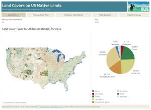
Land Covers on Native Lands in the Coterminous United States
About this Dashboard This data dashboard summarizes the total area for 16 land covers for 848 native land areas (reservations and off reservation trust lands)