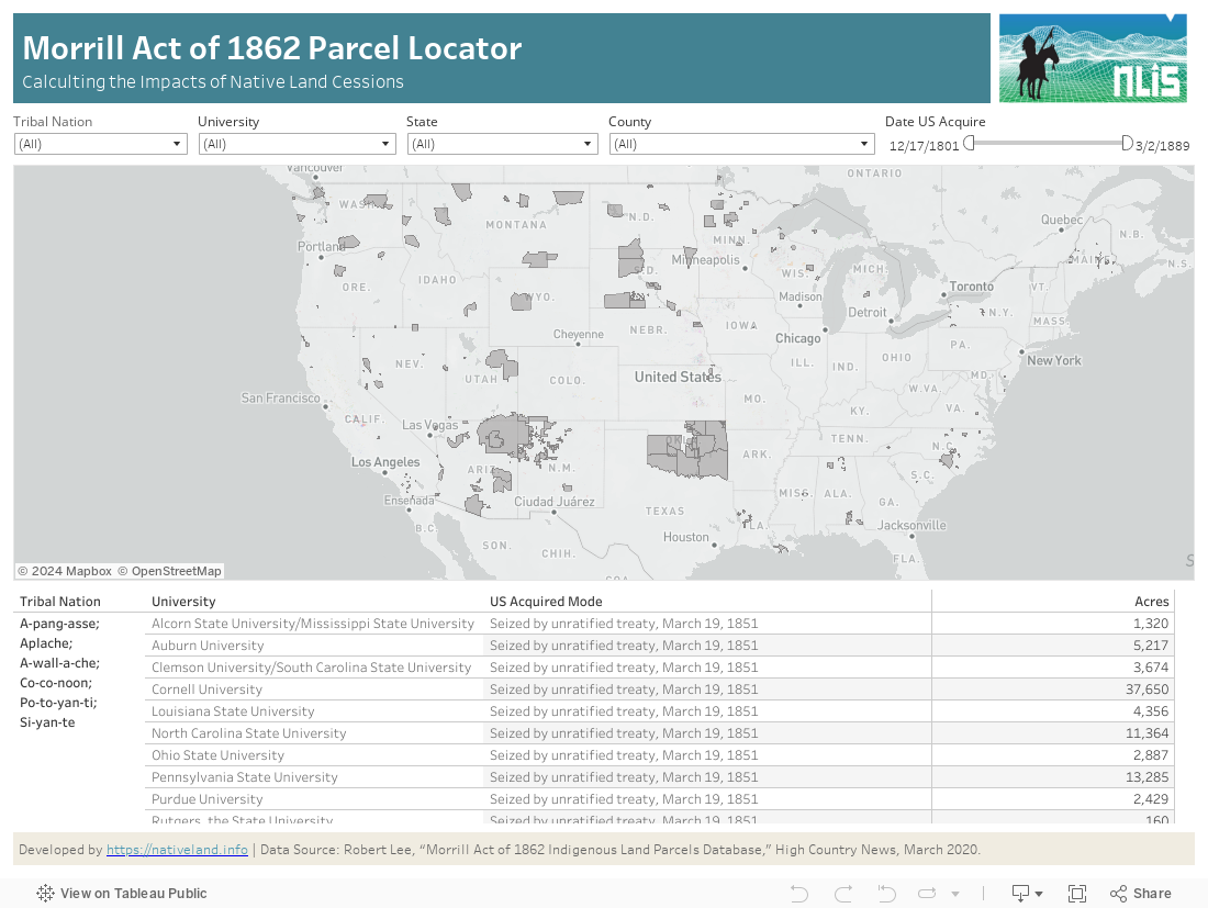
This data dashboard, developed by the Native Lands Advocacy Project, maps and summarizes parcel data for lands ceded from Native American Tribes and granted to Universities under the 1862 Morrill Act. This data was compiled and made available by High Country News for their March 2020 Feature “Land-grab Universities.” The original source of the data is the Bureau of Land Management’s GLO Database.
This data from the BLM’s General Land Office is the US Government’s authoritative source for granular information about land parcels seized from Native Lands. This dashbaord is valuable for Tribes and Native communities to begin to reconstruct how their lands were seized by the United States Government and distirbuted to specific universities. The data is valuable for Land Grant Universities to better understand how their formation and initial capitalization was directly tied to the disposession and marginalization of specific Native nations, an important step towards eventual reconciliation.
Learn what crops are growing on your lands & view crop trends over time. The CDL has been used in hundreds of studies on a range of topics from agriculture productivity, crop variability, impacts of climate change, climate resiliency studies, estimates of carrying capacity, etc. NLAP’s dashboard makes it easy for tribes to access the data for their own land, agriculture, and climate planning purposes.
May 14, 11-11:45 pm CDT