NLIS Launches New Interactive Data Visualization of US Hazardous Liquids Spills, Pipelines, and Reservation Lands
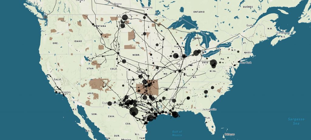
Today, the Native Land Information System launched a new interactive data visualization of US Hazardous Liquids Spills from 2010 to 2020. The viz draws on data from the US Department Transportation’s Pipeline and Hazardous Materials Safety Administration and displays 3,398 separate spills over a 10 year period or an average of 29 spills each month! The tool […]