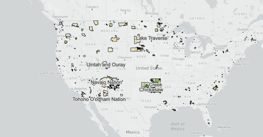
This map shows the canopy cover percentages and land cover types on Reservations and USFS lands.
JOIN OUR UPCOMING WEBINAR!
Land Cover on Native Lands
Learn how to access land cover data for your reservation using NLAP’s NLCD map and dashboard. Observe historical trends in land cover and use current data for land, climate, and agricultural planning.