ARMP-IRMP-Data Portal
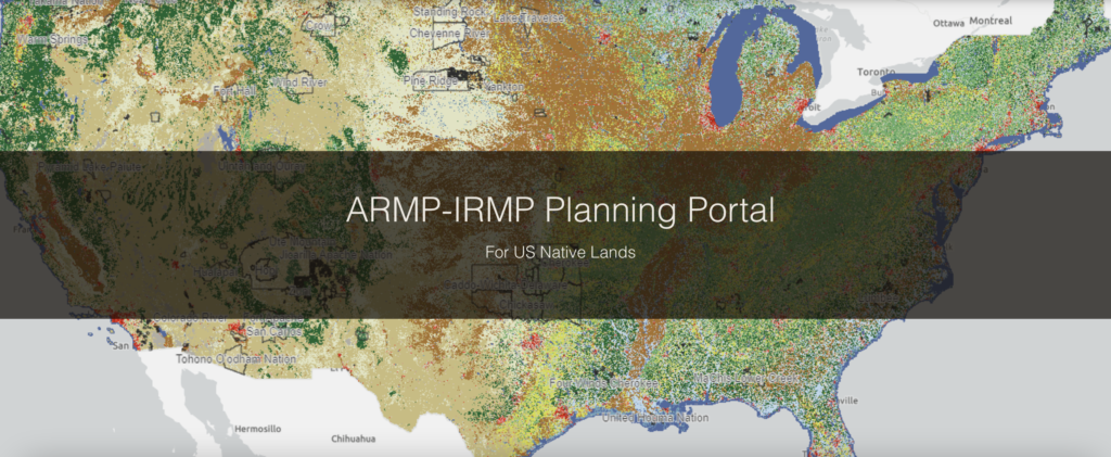
ARMP-IRMP Planning Portal A Toolkit for Tribal Resource Management Plans Welcome to the ARMP-IRMP Data Portal This resource was developed by the Native Lands Advocacy Project in partnership with the Intertribal Agriculture Council and the Indian Land Tenure Foundation to assist Tribes in the development of Agriculture Resource Management Plans (ARMPs) and Integrated Resources Management Plans […]
Rivers of Broken Promises: An Exploration of the Water Challenges Faced by Lakota Communities
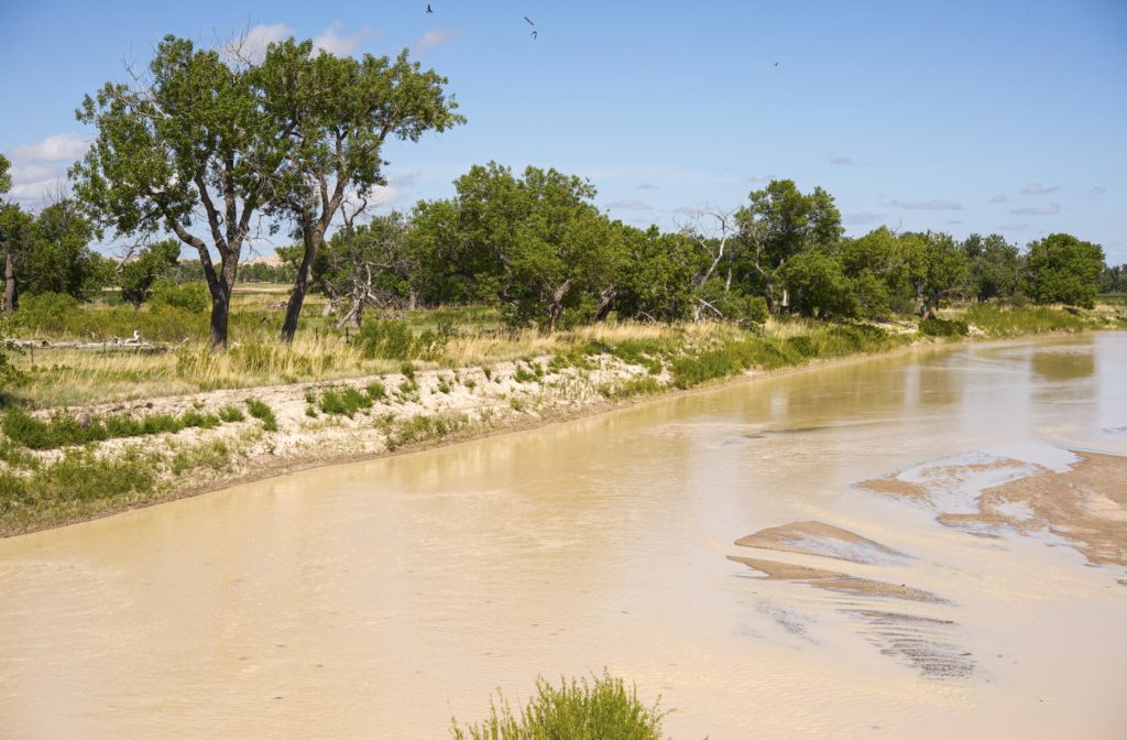
This blog is the first of two posts analyzing the challenges Native communities face in accessing clean, sustainable water.
Announcing Our New “Preserving Intact Habitat on Native Lands” Storymap!

What is intact habitat, and why is it important? How has preserving intact habitat been the key to addressing tribal priorities? What resource tools exist for tribes to utilize in their own intact habitat planning? To help answer these questions and more, NLAP is happy to announce our new storymap, Preserving Intact Habitat on US […]
Preserving Intact Habitat on US Native Lands

In this interactive storymap, we walk through the importance of habitat connectivity for Native lands in the United States, approaches to promoting habitat connectivity provided by Esri, and how different data tools — one of which being our very own intact habitat layer — may be used for further tribal protection of their homelands and non-human relatives.
Thermal Activity on US Native Lands
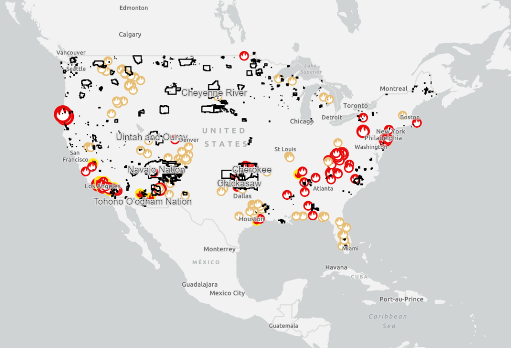
This map shows satellite detected hotspots and wildfire activity provided by federal, state, and local agencies.
Intact Habitat on US Native Lands
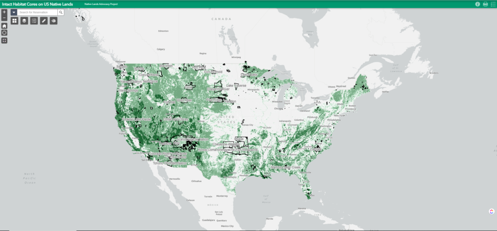
This layer represents modeled Intact Habitat Cores, or minimally disturbed natural areas at least 100 acres in size and greater than 200 meters wide.
Intact Habitat Selector Tool
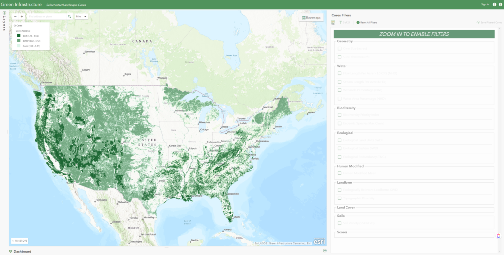
Explore and filter a national database of intact landscape cores to identify important habitat your tribe seeks to protect based on species richness, water availability, landscape variability, soils, etc.
ESRI Landsat Explorer
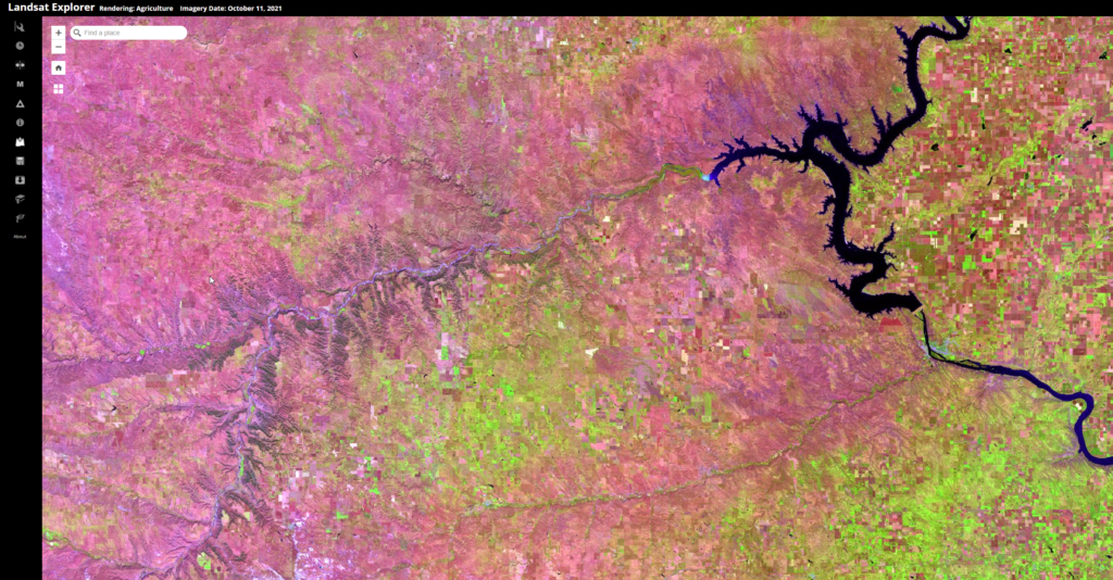
Esri Landsat Explorer app provides the power of Landsat satellites, which gather data beyond what the eye can see. Use this app to draw on Landsat’s different bands to better explore the planet’s geology, vegetation, agriculture, and cities. Additionally, access Landsat imagery from the last forty years to visualize how the Earth’s surface has changed over time.
Key Biodiversity Areas: A Tool for Tribal Climate Planning?

By Aude K. Chesnais “At a time where climate planning becomes urgent and global attention is increasing on the ecological value of land, Native Peoples’ land stewardship practices may well gain in recognition, which could strengthen tribal sovereignty in the US” Today, Indigenous peoples manage 80% of the world’s biodiversity, yet they receive only 0.74% […]