Announcing New Updates to Our National Land Cover Database Dashboard!
By Raven McMullin // April 18, 2022 NLAP remains committed to making available to Tribes, Native organizations, and land caretakers the most relevant and current data critical for Native land planning and research. In furtherance of this commitment, we are excited to announce new updates to our National Land Cover Database Dashboard (NLCD) along with a […]
New Tool for Native Land Caretakers: The Rangeland Analysis Platform (RAP)
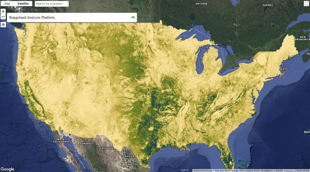
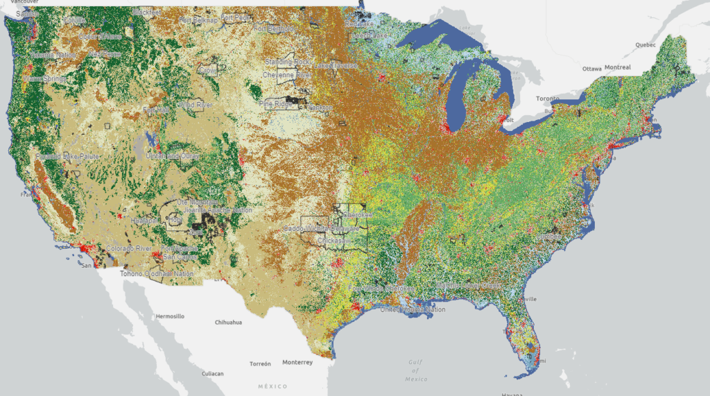
According to the NLIS’s National Land Cover Database dashboard, in 2019, there were approximately 26 million acres of rangeland within Native American reservations and off-reservation trust lands. Now, say that you are a Tribal natural resource manager, an established rancher, or land owner—it is no secret that adequately monitoring this vast land base, whether owner-managed […]
Maps
Maps Maps allow you to visually explore & interact with one or more data layers. Great for identifying and sharing areas of interest. Maps Maps Search Maps Agricultural Resources SSURGO Soil Classification Viewer for US Native Lands This map shows the canopy cover percentages and land cover types on Reservations and USFS lands. Agricultural Resources […]
NLIS Value-Added Data
The Rez-County Overlap Layer This GIS-based layer is a unique output of the Native Lands Advocacy Project and allows us to perform data analysis from datasets that do not match with reservation boundaries or who do not have any common identifiers to match external datasets. This layer is a work in progress and is used […]
Storymaps
STORYMAPS Storymaps are dynamic, interactive, and data rich narratives that create context and meaning for the data on the NLIS. Storymaps Storymaps Search Storymaps Sustainable Food-Systems for US Native Lands: Story Untold Pine Ridge Land Information System Stolen Futures STOLEN FUTURES Visualizing 178 Years of Lost Agricultural Revenue Powhatan village of Secoton, colour engraving by […]
Dashboards
DASHBOARDS Dashboards make large and complex datasets easier to visualize, sort, filter, compare and analyze, making the data more understandable and actionable. Once you have the desired filters set they can be easily screen captured and pasted into a slide show, report, or social media post. Dashboards Dashboards Search Dashboards Soil Capability on US Native […]